
Managing a road network is fundamentally a data challenge.
Road agencies and infrastructure owners need to understand what condition their roads are in, where deterioration is occurring, which sections require attention, and how maintenance budgets should be allocated. As road networks expand and infrastructure ages, relying on occasional inspections or isolated surveys can make it difficult to maintain a complete and current picture of network condition.
A road asset management system provides a structured approach to solving this challenge.
By combining road condition data, geographic information systems (GIS), pavement inspections, ride quality measurements, historical records, maintenance information, and asset intelligence, agencies can move from reactive maintenance toward more systematic and data-driven decision-making.
However, implementing a road asset management system does not necessarily mean surveying every kilometre with specialized engineering vehicles at frequent intervals.
A more scalable approach is to establish a network-wide monitoring and screening layer, using technologies such as smartphone-based road surveys, AI-powered visual inspections, GIS mapping, and recurring data collection. Platforms such as RoadBounce can support this layer by helping organizations monitor large road networks and identify locations that warrant more detailed investigation.
Traditional engineering profilers remain valuable for detailed engineering validation. The two approaches serve different purposes and can work together within a modern road asset management strategy.
What Is a Road Asset Management System?
A road asset management system is a structured framework for collecting, managing, analyzing, and using information about roads and associated infrastructure throughout their lifecycle.
The objective is not simply to store road data.
A well-designed system helps answer practical questions such as:
- Which roads are deteriorating?
- Where are ride quality issues developing?
- Which pavement sections should be investigated first?
- Which assets require preventive maintenance?
- Where should limited maintenance budgets be allocated?
- How has road condition changed over time?
- Which locations require detailed engineering assessment?
- Are maintenance interventions improving network condition?
A road asset management system can bring together information from multiple sources, including:
- Pavement condition surveys
- Roughness and ride quality measurements
- Visual distress inspections
- GIS data
- Road inventory databases
- Traffic information
- Construction and rehabilitation history
- Maintenance records
- Drainage and roadside asset information
- Historical survey results
- Engineering investigations
The result is a centralized view of the road network that supports better maintenance planning and infrastructure decision-making.
Why Road Asset Management Is Becoming More Important
Road infrastructure represents a significant long-term investment. At the same time, pavement deterioration is not linear.
A road can appear to remain in acceptable condition for years before deterioration accelerates. Once significant structural or surface problems become visible, the cost and complexity of intervention can increase.
This creates a fundamental maintenance challenge.
If an agency only responds after problems become obvious, maintenance can become reactive and expensive.
If it can identify changing conditions earlier, it may have more opportunities to consider preventive or lower-impact interventions.
This is where continuous road condition monitoring becomes valuable.
Instead of treating a road survey as a one-time event, agencies can establish recurring monitoring programs that show how road conditions evolve.
A modern road asset management system therefore needs to answer two questions:
Where are the problems today?
and
Where are conditions changing over time?
The second question is particularly important for preventive maintenance planning.
The Core Components of a Road Asset Management System
A practical implementation typically consists of several interconnected components.
1. Road Asset Inventory
The foundation of any road asset management system is an accurate asset inventory.
This may include:
- Road name
- Route identification
- Road section
- Geographic coordinates
- Lane information
- Pavement type
- Construction year
- Surface type
- Road hierarchy
- Traffic characteristics
- Maintenance history
- Associated infrastructure
Without a reliable inventory, condition information becomes difficult to organize and compare.
The asset inventory provides the framework against which other datasets can be connected.
2. Road Condition Monitoring
The next layer is understanding the physical condition of the network.
Condition monitoring may include measurements related to:
- Ride quality
- Surface distress
- Cracking
- Potholes
- Rutting
- Surface defects
- Roughness
- General pavement deterioration
Different technologies can collect different types of information.
For example, smartphone-based monitoring can provide a scalable way to collect road condition information across large networks while vehicles travel their normal routes.
This makes recurring network-level monitoring more practical.
3. Ride Quality and IRI Measurements
The International Roughness Index (IRI) is widely used as an indicator of longitudinal road roughness and ride quality.
IRI data can help agencies understand how smooth or rough a road section is and identify sections that warrant further investigation.
Smartphone-based road monitoring technologies can use vehicle-mounted smartphones and sensor data to estimate road roughness and support network-level screening.
However, the purpose of such monitoring should be clearly defined.
RoadBounce is designed to support network-wide road screening and monitoring, rather than replace engineering-grade profiling equipment.
The distinction is important.
Network Screening
The objective is to assess large portions of the network efficiently and identify:
- Potentially deteriorating sections
- Rough road segments
- Changing road conditions
- Locations requiring further investigation
- Maintenance priorities
Engineering Validation
Detailed engineering surveys have a different objective.
Traditional road profilers and specialized survey systems remain valuable when agencies require detailed engineering measurements, project-level investigations, or other applications requiring specialized instrumentation.
The two approaches are complementary.
Traditional profilers remain valuable for detailed engineering investigations, while smartphone-based monitoring solutions provide cost-effective network-wide screening and continuous monitoring.
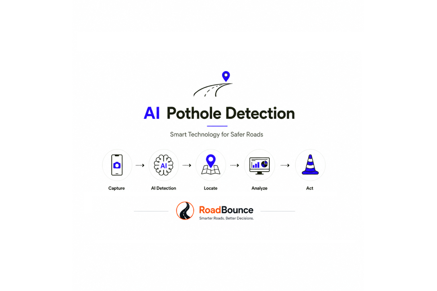
4. AI-Powered Visual Road Inspections
Ride quality measurements alone do not tell the complete story.
Two roads can have similar roughness values while exhibiting different types of surface distress.
This is why visual road inspections can add another important layer of intelligence.
AI-powered visual inspection technologies can analyze road imagery to identify potential features such as:
- Potholes
- Cracking
- Surface deterioration
- Road defects
- Pavement distress
- Other visually detectable conditions
When combined with geographic information, these observations can be mapped to specific road sections.
This creates a richer understanding of network condition.
Instead of asking only:
“Which roads are rough?”
an agency can begin asking:
“Which roads are rough, where are visible defects occurring, and how are these conditions changing?”
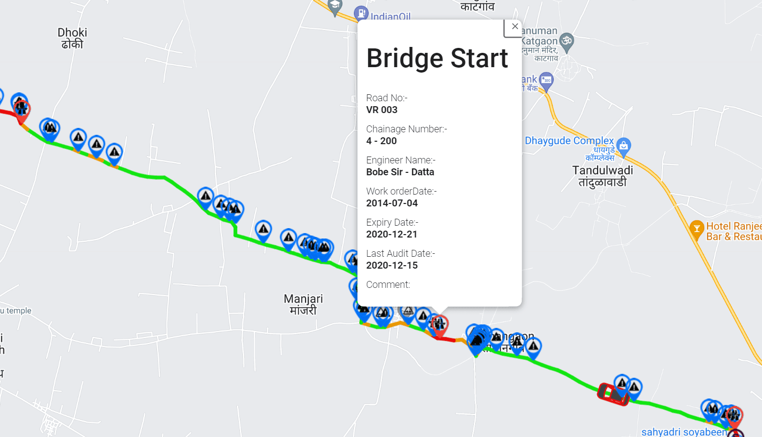
5. GIS-Based Road Asset Mapping
Geographic Information Systems are another essential component of modern infrastructure asset management.
GIS allows road condition information to be connected to physical locations.
A GIS-integrated road asset management system can visualize:
- Road condition
- Roughness
- Pavement distress
- Maintenance history
- Road classifications
- Survey routes
- Priority locations
- Asset boundaries
- Geographic trends
This makes complex datasets easier to understand.
For example, an infrastructure manager could visualize a road network and apply condition-based filters to identify sections with elevated roughness or repeated visual distress observations.
GIS therefore transforms raw survey information into spatial infrastructure intelligence.
6. Historical and Recurring Data
A single survey provides a snapshot.
Recurring surveys provide a trend.
This distinction is extremely important for road asset management.
Suppose a road section is surveyed in January and receives a particular condition value. That information is useful.
But if the same section is monitored again six months later and then again the following year, the agency can begin to understand its deterioration trajectory.
Historical data can help identify:
- Stable road sections
- Rapidly deteriorating sections
- Recurring problem areas
- Locations affected by seasonal changes
- Maintenance impacts
- Emerging network-wide trends
This is one of the key advantages of establishing a continuous monitoring program.
A Real-World Road Asset Management Implementation Framework
Implementing a road asset management system does not have to happen all at once.
A phased approach can make implementation more practical.
Step 1: Define the Network
Start by establishing the geographic scope of the road network.
Determine:
- Total road length
- Road classifications
- Geographic boundaries
- Responsible authorities
- Available asset records
- Existing survey coverage
Divide the network into logical road sections or segments.
This segmentation becomes important later when condition information is analyzed.
Step 2: Establish a Baseline
Before prioritizing maintenance, establish a baseline condition dataset.
The baseline should provide a broad understanding of current network condition.
Depending on the organization’s requirements, this may combine:
- Existing pavement condition records
- Historical survey data
- Smartphone-based road surveys
- Visual inspections
- GIS information
- Available engineering survey data
For large networks, a network-wide screening survey can provide a practical starting point for identifying areas requiring greater attention.
Step 3: Collect Network-Wide Condition Data
This is where scalable monitoring technologies become particularly useful.
A smartphone-based road survey platform can collect road condition information while vehicles travel across the network.
With an appropriate implementation, organizations can collect data across:
- Urban roads
- Rural roads
- Municipal networks
- Regional networks
- Large highway networks
- Industrial roads
- Private road networks
The objective is broad coverage.
Rather than concentrating resources on a small number of locations, network monitoring helps establish visibility across the entire road system.
Step 4: Combine Multiple Data Sources
A strong road asset management system should not depend on one metric.
For example, RoadBounce can combine information such as:
Ride Quality + Visual Inspection + Location + Historical Data
This provides a more comprehensive screening framework.
Consider a hypothetical example.
A road section shows:
- Increasing roughness
- Multiple visual distress observations
- Repeated deterioration over successive monitoring cycles
That section may receive a higher maintenance priority than another section showing stable condition.
The system does not need to automatically determine the engineering treatment.
Instead, it helps identify where engineering attention should be focused.
Step 5: Create a Network Condition Map
Once data has been collected, visualize the network.
A condition map can classify road sections according to organizational criteria such as:
- Good
- Monitor
- Investigate
- Maintenance priority
- Detailed assessment required
These classifications should be based on the organization’s own engineering standards, thresholds, asset-management policies, and decision-making framework.
The objective is to make the network easier to understand.
A road manager should be able to move from:
“We have thousands of kilometres of road.”
to:
“These sections require attention first, and these sections should be investigated in greater detail.”
Step 6: Prioritize Maintenance
Maintenance budgets are limited.
Consequently, road agencies need a structured method for prioritizing interventions.
A road asset management system can support prioritization using multiple variables, including:
- Condition
- Rate of deterioration
- Road classification
- Traffic importance
- Historical maintenance
- Distress severity
- Strategic importance
- Safety considerations
- Available budget
- Engineering assessment results
This enables agencies to move away from purely reactive maintenance decisions.
Instead, maintenance planning can become more transparent and data-driven.
Step 7: Validate Priority Locations
Network screening should not be confused with engineering validation.
When monitoring identifies a high-priority road section, the next step may be a more detailed investigation.
Depending on the project, this could involve:
- Engineering inspection
- Detailed pavement assessment
- Specialized profiler surveys
- Structural investigation
- Material testing
- Drainage investigation
- Other project-specific engineering assessments
This creates a powerful workflow:
Monitor → Screen → Prioritize → Investigate → Plan → Maintain → Monitor Again
RoadBounce supports the monitoring and screening stages of this workflow.
Specialized engineering technologies can then be deployed where detailed validation is required.
RoadBounce and the Modern Road Asset Management Workflow
RoadBounce is designed to provide a scalable monitoring layer for road networks.
Instead of positioning smartphone-based monitoring as a replacement for specialized profiling systems, its role is to help infrastructure organizations gain broader visibility across their networks.
A typical workflow can look like this:
1. Survey
Collect road condition data using smartphones and vehicle-based monitoring.
2. Measure
Capture ride-quality information and relevant sensor observations.
3. Inspect
Use AI-assisted visual analysis to identify potential pavement distress.
4. Map
Connect observations to geographic locations through GIS.
5. Analyze
Identify patterns, deterioration, and potentially problematic road sections.
6. Prioritize
Use condition intelligence to support maintenance planning.
7. Validate
Deploy detailed engineering surveys where required.
8. Monitor
Repeat surveys to understand how road conditions change.
This creates a continuous infrastructure intelligence cycle.
Why Continuous Road Monitoring Matters
Traditional road condition programs may occur periodically because detailed surveys can require significant planning, resources, and specialized equipment.
Continuous or recurring smartphone-based monitoring can complement these programs by increasing the frequency of network-level observations.
More frequent monitoring can help organizations identify changes sooner.
For example, an agency could establish recurring monitoring routes and compare results over time.
If a road section remains stable, it may not require immediate detailed investigation.
If conditions begin changing rapidly, it can be flagged for further assessment.
This allows specialized resources to be directed toward locations where they are most needed.
Road Asset Management Is More Than Pavement Condition
Although pavement condition is a major component, a complete road asset management strategy can extend beyond the pavement surface.
Depending on organizational requirements, infrastructure managers may also manage:
- Bridges
- Culverts
- Drainage infrastructure
- Signs
- Guardrails
- Street lighting
- Road markings
- Shoulders
- Traffic infrastructure
- Other roadside assets
A modern infrastructure intelligence platform can therefore become part of a broader asset management ecosystem.
Road condition data can be combined with other infrastructure datasets to create a more complete picture of network performance and maintenance requirements.
Preventive Maintenance and Road Asset Management
One of the central objectives of asset management is to make better decisions about when to intervene.
Waiting until a road reaches severe deterioration may reduce the available maintenance options.
Conversely, intervening too early can also result in inefficient allocation of resources.
The goal is to use condition and deterioration information to support appropriate intervention timing.
Recurring monitoring can contribute to this process by revealing changes in condition before they become widespread.
For infrastructure managers, this means moving from:
Reactive maintenance
toward:
Condition-informed maintenance planning
and eventually toward:
Proactive network management.
Building a Cost-Effective Road Survey Strategy
A common misconception is that road condition monitoring requires the entire network to be surveyed using the same expensive technology.
A more practical strategy can use different technologies at different stages.
Layer 1: Network Screening
Use scalable technologies to monitor large portions of the network.
This provides broad visibility.
Layer 2: Priority Identification
Use condition data, visual observations, GIS, and historical trends to identify sections requiring attention.
Layer 3: Engineering Investigation
Deploy specialized survey equipment and engineering resources to priority locations.
Layer 4: Maintenance Planning
Use validated information to develop appropriate maintenance strategies.
Layer 5: Recurring Monitoring
Continue monitoring to evaluate network changes and maintenance outcomes.
This approach allows organizations to use specialized engineering technologies where they provide the greatest value while maintaining broader visibility across the network.
Road Asset Management System: Example Implementation
Consider a municipality responsible for 2,000 kilometres of roads.
The municipality currently performs periodic inspections but struggles to maintain consistent network-wide visibility.
A practical implementation could begin with a baseline smartphone-based survey.
Phase 1: Baseline Survey
The entire road network is surveyed to establish initial condition information.
Phase 2: Data Integration
Road condition information is connected with:
- GIS
- Road inventory
- Historical maintenance
- Road classification
- Existing engineering data
Phase 3: Screening
Road sections showing potential deterioration are identified.
Phase 4: Prioritization
The municipality develops a prioritized list using condition information and its existing maintenance criteria.
Phase 5: Engineering Validation
Selected high-priority locations receive detailed engineering investigation using appropriate specialized equipment.
Phase 6: Maintenance
Validated findings inform maintenance planning and project development.
Phase 7: Recurring Monitoring
The network is monitored again periodically.
The result is not simply a database of road conditions.
It becomes a repeatable decision-support process.
Measuring the Success of a Road Asset Management System
Implementation should be measured using meaningful operational indicators.
Possible metrics include:
Network Coverage
What percentage of the road network has current condition information?
Monitoring Frequency
How frequently are roads being reassessed?
Data Freshness
How old is the condition information used for decision-making?
Priority Identification
How quickly can potentially deteriorating locations be identified?
Engineering Deployment
Are detailed engineering surveys being focused on priority locations?
Maintenance Planning
Can maintenance programs be supported with consistent condition information?
Deterioration Tracking
Can the organization identify how road conditions are changing over time?
These indicators help demonstrate whether the asset management system is improving network visibility and decision-making.
Common Road Asset Management Implementation Challenges
Incomplete Data
Many organizations have road information spread across spreadsheets, GIS systems, inspection reports, and historical documents.
Integrating these sources can be challenging.
Infrequent Surveys
If road conditions are measured only occasionally, deterioration between surveys can remain difficult to understand.
Limited Budgets
Agencies often need to monitor extensive networks with limited resources.
Data Fragmentation
Condition data, maintenance data, traffic data, and asset inventories may exist in separate systems.
Difficulty Prioritizing
Without consistent condition information, maintenance decisions can become heavily dependent on manual assessments or historical assumptions.
Scaling Specialized Surveys
Deploying engineering survey vehicles across an entire network at frequent intervals may not always be practical.
This is where a layered monitoring strategy can help.
How Smartphone Road Surveys Fit Into the Bigger Picture
Smartphones have evolved into powerful sensing devices containing technologies such as:
- Accelerometers
- Gyroscopes
- GPS
- Cameras
- Connectivity
- Computing capabilities
These capabilities make smartphones useful for scalable road monitoring applications.
A smartphone-based road survey does not need to replace specialized engineering equipment to provide value.
Its strength can be scale, accessibility, and repeatability.
A single monitoring platform can help organizations collect information across extensive networks using vehicles already travelling those roads.
This can support more frequent network-level screening and create a stronger foundation for infrastructure intelligence.
Network Screening vs. Engineering Validation
Understanding this distinction is critical when designing a road asset management strategy.
| Network Screening | Engineering Validation |
|---|---|
| Broad network coverage | Detailed investigation |
| Frequent monitoring | Project-specific surveys |
| Cost-effective scaling | Specialized equipment |
| Identifies potential priorities | Validates engineering conditions |
| Supports maintenance prioritization | Supports detailed engineering decisions |
| Smartphone and sensor-based technologies can contribute | Traditional profilers and engineering survey systems remain important |
| Continuous or recurring monitoring | Deployed where detailed information is required |
Neither layer needs to replace the other.
The most effective road asset management programs can use them together.
RoadBounce supports network-wide screening and recurring monitoring, while traditional profiling and engineering surveys remain important tools for detailed validation.
The Future of Road Asset Management
Road asset management is moving toward increasingly connected and data-driven infrastructure operations.
Future systems are likely to combine:
- Smartphone sensing
- AI-based image analysis
- GIS
- Cloud platforms
- Historical condition databases
- Automated reporting
- Predictive analytics
- Digital asset inventories
- Recurring monitoring
The objective is not simply to collect more data.
It is to transform data into actionable infrastructure intelligence.
A road agency should ultimately be able to understand:
What is happening?
Where is it happening?
How quickly is it changing?
What requires attention?
What level of investigation is appropriate?
How should maintenance resources be prioritized?
These questions form the foundation of modern road asset management.
Conclusion
A road asset management system provides the framework organizations need to understand, monitor, and manage road infrastructure throughout its lifecycle.
However, successful implementation is not simply about purchasing a software platform or conducting a single road survey.
It requires a repeatable process that connects:
Asset Inventory → Network Monitoring → Condition Assessment → GIS → Analysis → Prioritization → Engineering Validation → Maintenance → Recurring Monitoring
Smartphone-based road monitoring can play an important role within this framework by providing scalable network-level visibility.
RoadBounce is designed for this purpose.
It helps road agencies, consultants, contractors, and infrastructure owners monitor extensive networks, collect condition information at scale, identify potential deterioration, integrate road intelligence with geographic information, and prioritize locations for further investigation.
The role is complementary rather than substitutive.
Traditional profilers remain valuable for detailed engineering investigations, while smartphone-based monitoring solutions provide cost-effective network-wide screening and continuous monitoring.
By combining both approaches, organizations can build a more responsive and data-driven road asset management strategy—one that continuously monitors the network while directing specialized engineering resources toward the locations where detailed investigation is most needed.
In modern infrastructure management, the goal is not simply to survey more roads.
It is to build better visibility, better prioritization, and better decisions across the entire network.

Leave a Reply