
Potholes are among the most visible signs of road deterioration, but identifying them quickly and coordinating effective repairs across an extensive road network can be challenging. For road authorities, municipal corporations, highway operators, and infrastructure management teams, the problem extends beyond fixing individual potholes. It involves understanding where road damage occurs, how frequently it develops, which locations require urgent attention, and how maintenance resources can be deployed efficiently.
Traditional road inspections often rely on manual surveys, public complaints, periodic field assessments, and reports from maintenance personnel. While these methods remain useful, they may not provide a sufficiently comprehensive or up-to-date picture of changing road conditions across large networks.
This is where pothole location data can transform road maintenance operations.
By combining geospatial information, smartphone-based road condition monitoring, AI-powered visual inspections, and recurring assessments, infrastructure teams can develop a clearer understanding of pavement deterioration. Instead of responding only after damage becomes a major problem, road agencies can use data to identify affected locations, prioritize inspections, coordinate repairs, and monitor road conditions over time.
Platforms such as RoadBounce support this shift by helping infrastructure stakeholders move towards scalable, data-driven road monitoring and more proactive pavement management.
What Is Pothole Location Data?
Pothole location data refers to geographically referenced information about potholes and related pavement defects. It identifies where road damage occurs and can provide additional context to help maintenance teams assess the condition of affected road sections.
Depending on the data collection method and monitoring platform, pothole records may include:
- Geographic coordinates: The approximate latitude and longitude of a detected pothole.
- Road identification: The road name, route number, corridor, or road segment where the defect is located.
- Visual evidence: Images or AI-assisted observations showing the visible pavement distress.
- Condition information: Available indicators describing the type, extent, or apparent severity of the damage.
- Survey timestamps: The date and time when the location was assessed.
- Repeat observations: Records that help identify whether damage persists, changes, or reappears after repairs.
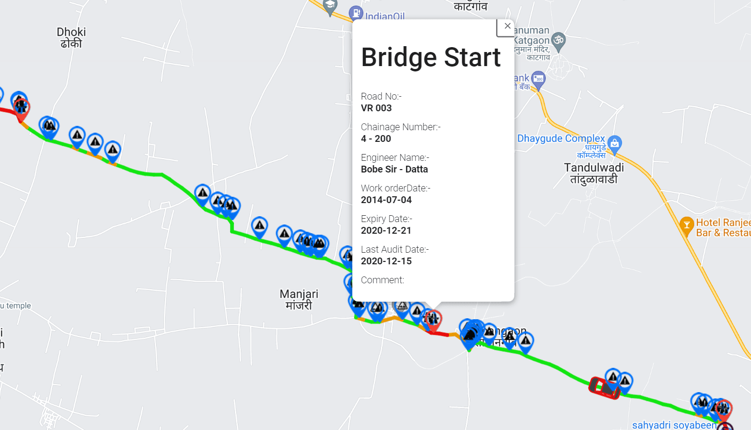
- GIS mapping: Spatial visualization of potholes and other road condition observations across the network.
The availability and reliability of these attributes depend on the survey technology, collection conditions, and validation process.
When organized into a consistent road asset management system, this information becomes more than a collection of defect reports. It becomes an operational resource for understanding road conditions, allocating maintenance resources, and planning future interventions.
1. Moving from Reactive Repairs to Proactive Road Maintenance
One of the biggest challenges in road maintenance is the tendency to act only after a pothole has become visible to road users, generated complaints, or caused disruption.
Reactive maintenance can create operational pressure. Teams must investigate reports, verify locations, arrange equipment, allocate workers, and determine which repairs should take priority. When information is incomplete or outdated, these activities can involve unnecessary travel, repeated inspections, and delays.
Pothole location data provides a more structured starting point.
By mapping identified defects and updating observations through recurring road surveys, maintenance teams can see where issues have been reported or detected. They can use this information to schedule inspections, group nearby repairs, and identify road sections that require closer attention.
For example, if multiple potholes are detected along a frequently used urban corridor, the maintenance team can assess the affected stretch as a coordinated work package rather than treating every defect as an isolated complaint.
This approach supports a transition from purely reactive repairs towards proactive road maintenance planning.
It does not eliminate the need for field inspections or engineering assessments. Instead, it helps teams identify where those activities are most likely to be useful.
2. Identifying High-Priority Potholes Across Large Road Networks
Not every pothole presents the same level of operational urgency. A defect on a busy arterial road may require faster intervention than a similar defect on a lightly trafficked local street. Other factors, including road function, exposure to heavy vehicles, observed deterioration, and the potential consequences of leaving the defect untreated, also influence maintenance decisions.
Without reliable location data, prioritization may depend heavily on the order in which complaints arrive or the observations of individual inspectors.
Geospatial pothole data allows road agencies to consider defects in their broader network context.
High-traffic corridors
Roads with substantial traffic volumes may deserve earlier investigation because defects can affect many road users and create operational disruption.
Locations with significant visible deterioration
Areas showing extensive or recurring pavement damage can be flagged for field verification and appropriate maintenance planning.
Road sections requiring repeated intervention
Locations where defects repeatedly appear may need investigation into underlying pavement, drainage, loading, or construction issues rather than repeated isolated repairs.
When combined with traffic information, road classifications, maintenance history, and field verification, pothole location data helps agencies establish transparent, consistent repair priorities.
The objective is not simply to count potholes. It is to understand which locations warrant attention first and why.
3. Improving Maintenance Crew Deployment and Operational Efficiency
Road maintenance involves more than identifying defects. Teams must travel to affected locations, transport materials, arrange traffic management, deploy suitable equipment, and complete repairs within available time and budget.
Poorly organized defect information can make these activities less efficient.
For example, when repair locations are scattered across a city, crews may spend considerable time moving between sites. If potholes are identified and mapped in advance, supervisors can group nearby repair tasks into geographically organized work packages.
This can help maintenance departments:
- Plan more efficient repair routes.
- Coordinate crews working in the same area.
- Reduce avoidable repeat visits caused by unclear or incomplete location information.
- Prepare equipment and materials according to anticipated work requirements.
- Coordinate inspections and repairs with other road maintenance activities.
- Maintain a clearer record of outstanding defects and completed work.
GIS-integrated road condition monitoring can further improve coordination by displaying pothole observations alongside road segments, administrative boundaries, and other relevant infrastructure information.
These capabilities can support better operational planning, although actual savings depend on network size, existing workflows, data quality, and how effectively teams use the information.
4. Using Smartphone-Based Road Monitoring to Scale Data Collection
Maintaining an accurate record of potholes across thousands of kilometres of roads presents a significant data collection challenge.
Manual inspections can provide valuable information, but regularly surveying an entire network may require considerable personnel, travel, and coordination. Infrequent assessments can also leave gaps between inspections, making it harder to understand how conditions are changing.
Smartphone-based road monitoring offers another approach to network-level screening.
Using suitable smartphone sensors, location information, and compatible data collection methods, monitoring platforms can support the collection of road condition observations across repeated journeys. Depending on the solution and survey configuration, this may include ride-quality indicators, geospatial records, and imagery for visual pavement assessment.
AI-powered visual inspection can help identify potential potholes and other visible pavement distress from collected imagery. These detections can then support mapping, review, and prioritization workflows, subject to the system’s capabilities and validation requirements.
The benefits of a scalable monitoring approach include:
- Broader coverage: Collect road condition information across larger networks without relying exclusively on intensive, location-by-location inspection.
- More frequent assessments: Repeat surveys to understand how road conditions change over time.
- Consistent records: Organize observations in a common framework for comparison and analysis.
- Earlier identification of potential issues: Flag locations that may warrant inspection before they become higher-priority maintenance problems.
- Better deployment of specialist resources: Identify corridors where detailed investigation should be concentrated.
RoadBounce supports this network-screening approach by combining smartphone-based road monitoring with road condition intelligence, including IRI-related ride-quality measurements, AI visual inspections, GIS mapping, and recurring monitoring capabilities.
The value lies in expanding the visibility of road conditions across the network, rather than depending entirely on isolated inspections or complaints.
5. Connecting Pothole Location Data with Pavement Condition and Ride Quality
A pothole is an important indicator of pavement distress, but it does not tell the entire story about a road’s condition.
Some road sections may exhibit uneven surfaces, cracking, deformation, or declining ride quality before severe potholes become widespread. Other sections may contain visible defects that require immediate attention despite relatively acceptable ride-quality measurements.
For this reason, road maintenance decisions benefit from combining different types of condition information.
| Data source | How it supports maintenance |
|---|---|
| Pothole location data | Identifies where visible defects have been detected. |
| AI-assisted visual inspection | Supports the identification and mapping of visible pavement distress. |
| International Roughness Index (IRI) measurements | Provides an indicator of longitudinal road roughness and ride quality. |
| GIS mapping | Shows the geographic distribution of road condition observations. |
| Historical survey records | Helps identify recurring defects and changing conditions. |
| Maintenance records | Shows where repairs were performed and supports follow-up assessments. |
The International Roughness Index (IRI) is a widely used measure of longitudinal road roughness. It can contribute to a broader understanding of ride quality, but it should not be treated as a direct measurement of pothole severity or as a complete assessment of pavement condition.
Similarly, AI-generated defect detections are useful screening inputs, but the results may require verification depending on the application and the consequences of the maintenance decision.
By combining complementary datasets, infrastructure teams can develop a more comprehensive picture of network condition and identify locations that require further investigation.
6. Supporting Better Maintenance Budget Allocation
Road maintenance budgets are limited, while the number of roads requiring attention can be substantial. Infrastructure managers must balance immediate repair needs against preventive maintenance, rehabilitation projects, routine inspections, and long-term asset preservation.
Pothole location data can support more evidence-based allocation of these resources.
A mapped inventory of observed defects helps agencies understand where maintenance needs are concentrated. When the data is combined with road importance, traffic exposure, pavement condition, historical repair costs, and available budgets, decision-makers can compare competing maintenance priorities more systematically.
For example, an agency may identify several corridors with recurring pavement defects. One corridor may require localized repairs, while another may show broader deterioration that warrants a detailed engineering investigation and consideration of a larger rehabilitation treatment.
Location data helps distinguish where problems occur. Additional condition information and engineering assessment help determine what intervention is appropriate.
This distinction is essential for effective pavement management.
Network screening helps determine where to investigate; engineering assessment helps determine the appropriate treatment.
RoadBounce can support the screening and prioritization stage by helping infrastructure teams gather condition information across their networks and identify locations for closer assessment.
7. Monitoring Whether Repairs Deliver Lasting Results
Repairing a pothole does not necessarily mean the underlying road problem has been resolved. Defects may reappear because of water infiltration, drainage problems, repeated heavy loading, pavement weakness, or inadequate repair methods.
Without reliable historical information, it can be difficult to determine whether a road section is improving or repeatedly returning to a poor condition.
Recurring pothole location data can help establish a history of observed defects and maintenance interventions.
By comparing records collected before and after repairs, road agencies can investigate questions such as:
- Has the previously affected location shown signs of recurring damage?
- Are similar defects appearing nearby?
- Does the road section require further inspection?
- Are some corridors experiencing repeated maintenance demands?
- Should the agency investigate possible drainage or structural issues?
These comparisons depend on consistent location referencing, suitable survey frequency, and reliable maintenance records. Changes in observations should also be interpreted carefully because differences in survey coverage or detection conditions may affect the results.
Over time, a structured history of road condition observations can help agencies identify recurring problem areas, evaluate maintenance patterns, and improve future planning.
8. Improving GIS-Based Road Asset Management
Geographic Information Systems (GIS) provide an effective way to connect road condition observations with the physical road network.
When pothole data is linked to mapped road segments, agencies can view the spatial distribution of defects rather than relying on disconnected spreadsheets or individual inspection reports.
GIS-integrated road asset management can support:
- Mapping pothole locations across municipal, regional, and highway networks.
- Identifying clusters of defects and corridors with recurring problems.
- Comparing road condition observations across administrative areas.
- Linking defects to road segments, maintenance histories, and other asset records.
- Developing maps and reports for maintenance planning.
- Supporting coordination between inspection teams, supervisors, and infrastructure managers.
This approach also makes road condition information easier to communicate to stakeholders. A map showing the location and distribution of observed defects can provide a clearer basis for discussing maintenance priorities than a list of unreferenced complaints.
When updated through recurring surveys, GIS-based monitoring can become an important part of a broader road network intelligence system.
9. Integrating Network Screening with Traditional Road Profilers
Smartphone-based road monitoring and traditional road profiling serve complementary roles in road management.
Specialized road profilers remain valuable for detailed engineering investigations and applications requiring appropriately specified and validated measurements. Depending on the project requirements, these surveys may be needed for detailed roughness assessment, engineering analysis, quality control, or acceptance-related work.
However, deploying specialized survey equipment across an entire network for every monitoring cycle may not be necessary or practical for every operational objective.
A network-wide screening approach can help identify where road condition changes or potential defects warrant closer attention.
The distinction can be understood as follows:
Network screening — RoadBounce
Scalable road condition observations, smartphone-based monitoring, IRI-related measurements, AI-assisted visual inspection, GIS mapping, and recurring network assessments.
Purpose: Identify road sections and locations that may require attention or more detailed investigation.
Engineering validation — Traditional profilers
Specialized surveys using equipment and procedures appropriate to the project’s engineering requirements.
Purpose: Conduct detailed measurements and validation where required by engineering specifications or project needs.
Traditional profilers remain valuable for detailed engineering investigations, while smartphone-based monitoring solutions provide cost-effective network-wide screening and continuous monitoring.
This complementary model helps agencies use specialized surveys strategically. Rather than treating all road sections as equally urgent, they can use network-level information to identify priority locations for more detailed assessment.
10. Building a Practical Pothole Data Management Workflow
To realize the operational value of pothole location data, agencies need a repeatable workflow that connects data collection with real maintenance decisions.
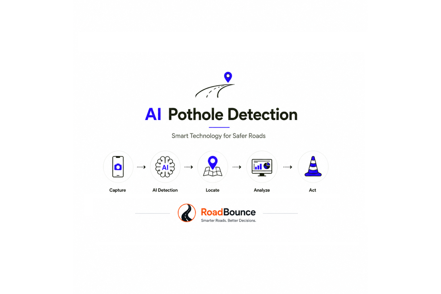
A practical process can follow these six steps.
1. Collect road condition observations
Conduct smartphone-based surveys, visual inspections, or other suitable assessments to identify potential potholes and related pavement distress.
2. Map and organize the findings
Associate observations with geographic coordinates and relevant road segments, while maintaining timestamps and supporting evidence where available.
3. Review and validate priority detections
Check data quality and use field inspections or suitable technical assessments where required, especially for high-consequence decisions.
4. Prioritize maintenance activities
Consider defect characteristics, road importance, traffic exposure, safety implications, deterioration patterns, and available resources.
5. Coordinate repairs and record completion
Assign work, organize crews, document interventions, and update maintenance records.
6. Repeat surveys and evaluate changes
Reassess affected road sections to identify recurring defects, changing conditions, and locations that may require additional investigation.
The process creates a feedback loop between road monitoring and maintenance operations. Each survey contributes to a more useful historical record, while completed maintenance activities help inform subsequent assessments.
Key Benefits of Pothole Location Data for Road Authorities
The operational value of pothole location data extends beyond finding individual defects.
| Operational area | Potential benefit |
|---|---|
| Road inspections | Better visibility of potential defects across the network. |
| Maintenance prioritization | More consistent decisions about which locations require attention first. |
| Crew scheduling | Improved geographic grouping of repair activities. |
| Budget planning | Stronger evidence for comparing maintenance requirements. |
| Preventive maintenance | Better identification of changing conditions and recurring problem areas. |
| Asset management | More structured road condition histories linked to geographic locations. |
| Engineering investigations | Better identification of locations where detailed surveys may be warranted. |
| Performance monitoring | Improved ability to review recurring defects and maintenance outcomes. |
These benefits are not automatic. They depend on data quality, survey coverage, appropriate prioritization criteria, integration with existing systems, and the ability of maintenance teams to act on the findings.
How RoadBounce Supports Smarter Road Maintenance Operations
Road agencies need more than isolated pothole reports to manage increasingly complex road networks. They need a scalable way to understand where road conditions are changing, how problems are distributed, and where limited inspection and maintenance resources should be focused.
RoadBounce supports this need through smartphone-based road condition monitoring and infrastructure intelligence.
Its network-screening approach can help infrastructure stakeholders combine relevant road condition indicators, including IRI-related ride-quality measurements, AI-assisted visual inspections, GIS mapping, and recurring monitoring, to develop a broader understanding of network conditions.
For pothole management, this approach can help teams:
- Identify locations with potential pavement distress.
- Map road condition observations across large geographic areas.
- Track road conditions through repeated monitoring.
- Highlight corridors that may require maintenance attention.
- Support data-informed maintenance prioritization.
- Identify locations where field verification or specialized engineering surveys may be necessary.
The result is a more structured basis for planning road inspections and maintenance activities.
RoadBounce is not intended to replace engineering-grade profiling, acceptance testing, or specialized validation surveys. Instead, it complements these methods by supporting network-wide screening and more frequent road condition monitoring.
For infrastructure owners managing extensive road networks, this distinction is important: broader monitoring helps identify where attention is needed, while specialized assessments help determine the engineering response.
Conclusion: Turn Pothole Locations into Actionable Road Intelligence
Pothole location data can transform road maintenance by connecting defect identification with mapping, prioritization, resource allocation, and ongoing condition monitoring.
When road agencies can see where damage occurs, understand how it relates to the wider network, and compare observations over time, they are better positioned to organize inspections, coordinate repairs, investigate recurring problems, and make informed maintenance decisions.
Smartphone-based monitoring and AI-assisted visual inspections offer a scalable way to support this process. Combined with GIS analytics, ride-quality indicators, maintenance histories, and traditional engineering surveys where required, they contribute to a more comprehensive approach to pavement management.
The goal is not simply to collect more pothole reports. It is to build a reliable understanding of road conditions and use that information to direct attention where it can make the greatest operational difference.
RoadBounce helps infrastructure teams move from isolated road observations towards continuous road network intelligence — supporting smarter screening, better maintenance planning, and more informed infrastructure management.
Explore how RoadBounce can support your road monitoring and pavement management strategy.

Leave a Reply