
Road networks are essential to economic growth, urban mobility, freight transportation, and public safety. However, maintaining these networks is becoming increasingly complex as traffic volumes rise, infrastructure ages, and maintenance budgets face growing pressure. Traditional road maintenance approaches, which often rely on periodic inspections and reactive repairs, can make it difficult for road authorities to identify deterioration early and allocate resources efficiently.
This is where road data analytics is transforming the way infrastructure is monitored, assessed, and maintained.
By combining road condition measurements, artificial intelligence (AI), geographic information systems (GIS), and recurring monitoring, road agencies can gain a clearer understanding of network conditions and make more informed maintenance decisions. Instead of relying exclusively on isolated inspections or reported defects, infrastructure managers can use structured data to identify emerging problems, compare road segments, and prioritize interventions.
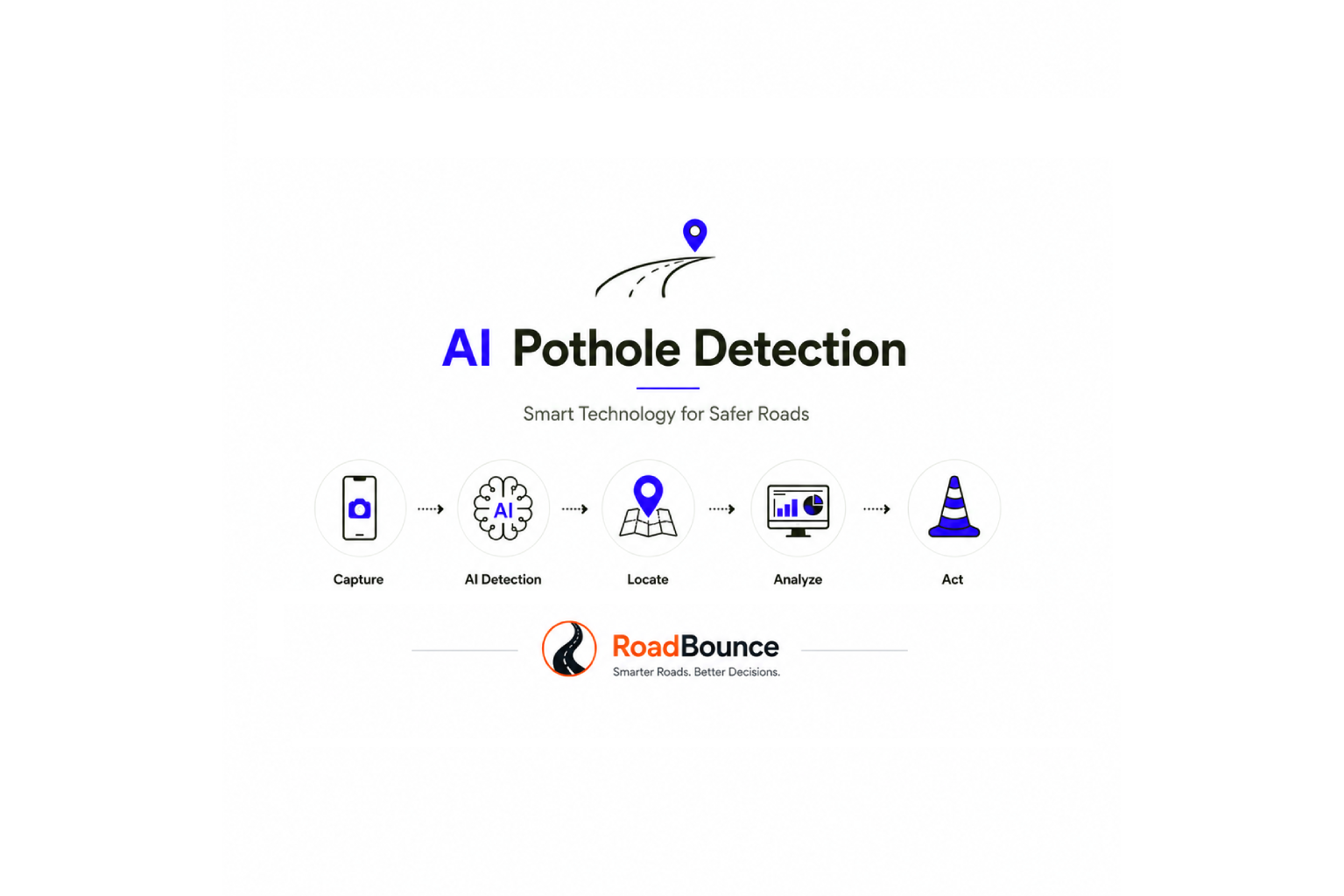
Modern platforms such as RoadBounce support this shift by enabling smartphone-based road condition monitoring at network scale. By bringing together ride-quality measurements, AI-powered visual inspections, and location-based infrastructure intelligence, RoadBounce helps agencies understand where deterioration may be occurring and where more detailed engineering investigations should be considered.
The result is a more proactive approach to pavement management—one that emphasizes continuous monitoring, informed prioritization, and better use of maintenance resources.
What Is Road Data Analytics?
Road data analytics is the process of collecting, processing, interpreting, and analyzing information about road conditions and infrastructure performance to support maintenance planning and asset management.
It transforms raw observations and measurements into actionable insights that help road authorities understand the condition of their networks, recognize deterioration patterns, and determine which locations may require attention.
Depending on the monitoring program, road data analytics may incorporate:
- International Roughness Index (IRI): A standardized indicator of longitudinal road roughness used to assess ride quality.
- AI-powered pavement distress detection: Computer vision techniques that help identify visible defects, including cracks and potholes.
- Geospatial data: GPS coordinates and GIS mapping that associate road condition information with specific locations.
- Traffic and usage information: Data that helps contextualize road deterioration and maintenance requirements.
- Historical condition records: Repeated measurements used to identify changes over time.
- Environmental and operational information: Factors such as rainfall, flooding, temperature variations, and heavy vehicle movements that can influence pavement performance.
When these datasets are analyzed together, they provide a more comprehensive picture of road network health.
For example, a road segment showing worsening ride quality alongside visible cracking may warrant closer investigation than a segment with stable measurements and no significant observed distress. Analytics helps identify such patterns, while engineering assessment determines the appropriate diagnosis and treatment.
Why Traditional Road Maintenance Needs Better Data
Many road maintenance programs have historically depended on scheduled inspections, public complaints, manual surveys, and repairs initiated after defects become apparent.
Although these methods remain useful, they can leave gaps in network visibility.
1. Limited Network Coverage
Detailed road condition surveys require planning, specialist equipment, trained personnel, and operational coordination. As a result, comprehensive assessments may not occur as frequently as road agencies would prefer.
Without regular information, maintenance teams may have limited visibility into conditions between scheduled surveys.
2. Reactive Maintenance Decisions
When road defects are discovered only after they become noticeable or generate complaints, opportunities for earlier intervention may be missed.
A data-driven monitoring program can help identify changes in road condition before they develop into more extensive maintenance concerns, although the timing and effectiveness of intervention depend on pavement type, defect characteristics, and local conditions.
3. Fragmented Infrastructure Information
Road roughness measurements, visual inspection reports, GIS records, maintenance histories, and contractor observations may be stored in separate systems.
When these datasets are not connected, comparing road segments and establishing consistent maintenance priorities becomes more difficult.
4. Competing Budget Priorities
Road authorities rarely have unlimited maintenance budgets. They must decide which roads require immediate attention, which can be monitored, and which interventions can be planned for future maintenance cycles.
Road data analytics supports these decisions by providing a more consistent evidence base for comparing network conditions and evaluating maintenance needs.
How Road Data Analytics Is Transforming Road Maintenance
1. From Periodic Surveys to Recurring Road Monitoring
One of the most important changes in road asset management is the shift from occasional condition surveys towards more frequent monitoring.
Traditional road surveys provide valuable information at a particular point in time. However, road conditions can change between inspections because of traffic loading, weather events, drainage issues, construction activity, and natural pavement deterioration.
Recurring monitoring helps infrastructure managers understand how conditions evolve rather than relying exclusively on historical snapshots.
Smartphone-based road monitoring technologies, such as RoadBounce, support this approach by enabling road condition data collection across larger networks using suitable mobile devices and survey vehicles.
Depending on the monitoring configuration, agencies can repeat assessments along selected routes, compare observations over time, and identify road segments that may require further investigation.
This approach is particularly useful for:
- Municipal and urban road networks.
- Regional and rural road systems.
- Large highway networks requiring screening.
- Fleet-based road condition monitoring programs.
- Infrastructure owners managing extensive road assets.
The objective is not simply to collect more data. It is to establish a repeatable process for understanding road conditions and responding to meaningful changes.
2. Using IRI Data to Understand Ride Quality
The International Roughness Index (IRI) is widely used to characterize longitudinal road roughness. It provides a standardized measure that helps infrastructure managers assess ride quality and compare road condition information.
Road data analytics can help agencies examine IRI measurements across multiple road segments, identify locations with comparatively poor ride quality, and track changes over successive monitoring periods.
When interpreted alongside other information, IRI data can support decisions about where additional assessment or maintenance planning may be warranted.
For example, a road authority could use network-wide screening to identify several corridors with elevated or worsening roughness indicators. These corridors could then be prioritized for field inspection or more detailed engineering surveys.
Smartphone-based monitoring can help expand the frequency and geographic coverage of ride-quality screening. However, measurement methods, vehicle setup, calibration, operating conditions, and data processing influence the results and their suitability for different applications.
For acceptance testing, contractual compliance, or engineering investigations requiring specialized measurements, the appropriate validated survey method should be used.
3. Detecting Pavement Distress with Artificial Intelligence
Visible pavement defects can provide important information about road condition and potential maintenance requirements.
AI-powered visual inspection systems use computer vision techniques to analyze road imagery and identify potential distress features, such as:
- Potholes.
- Longitudinal cracks.
- Transverse cracks.
- Surface cracking patterns.
- Other visible pavement defects supported by the detection model.
When these observations are linked to geographic coordinates, road agencies can identify potential defect locations and organize follow-up inspections more efficiently.
AI-assisted inspection can also support consistent data collection across large networks, reducing dependence on unstructured observations alone.
However, AI detections should be treated as inspection indicators rather than definitive engineering diagnoses. Performance depends on image quality, lighting, weather, road surface characteristics, and the capabilities of the detection model. Human review or field verification may be necessary before maintenance decisions are finalized.
For RoadBounce, AI-powered visual inspection complements road condition measurements by adding another layer of information to the network screening process.
4. Combining Road Condition Data with GIS Mapping
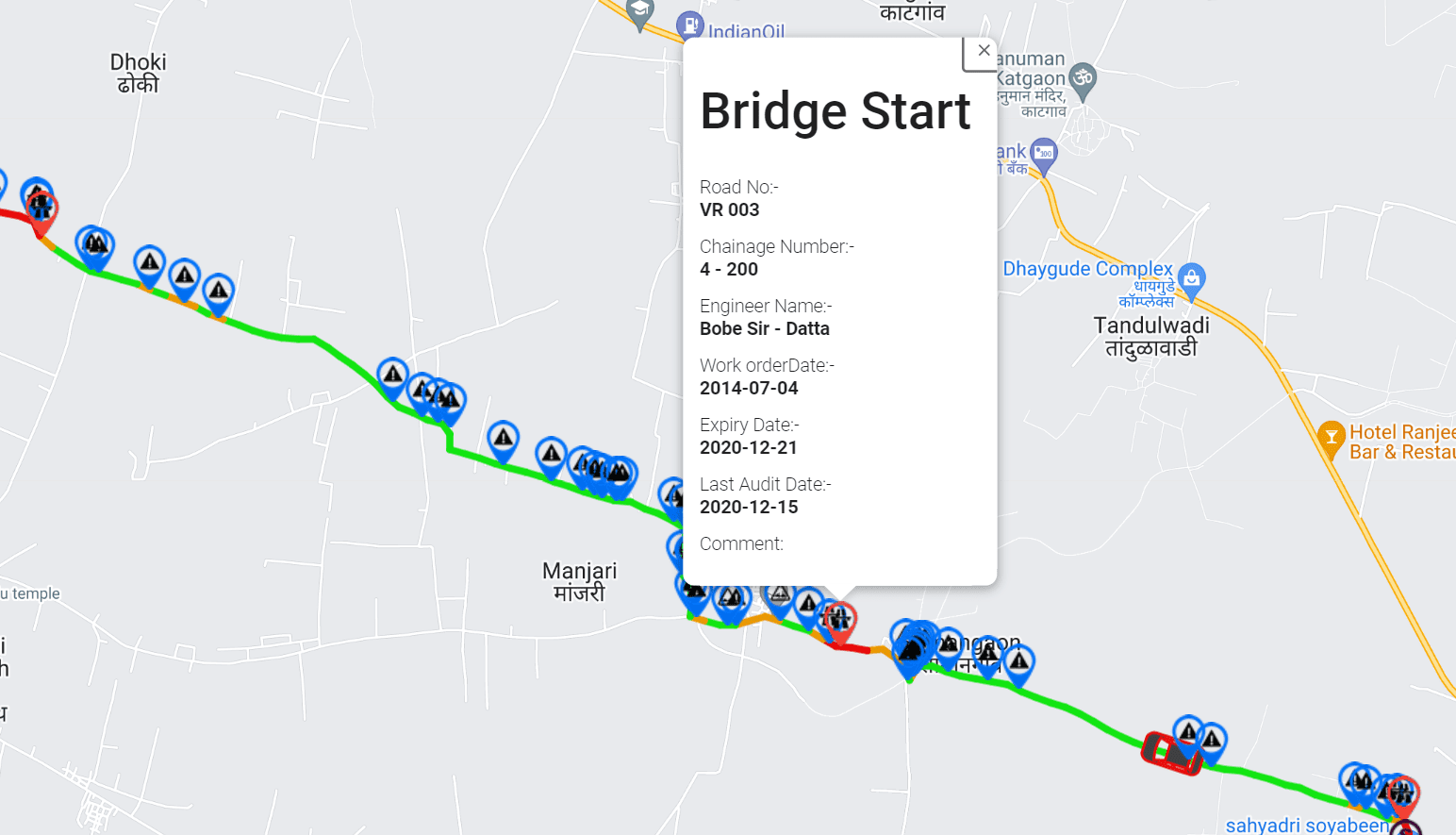
Geographic information systems play a central role in transforming road condition measurements into practical maintenance intelligence.
Without location context, a roughness value or pavement defect observation has limited operational usefulness. GIS connects the observation to a specific road segment, corridor, or geographic area.
By integrating road condition information with digital maps, infrastructure managers can:
- Visualize road condition variations across a network.
- Locate reported or detected pavement defects.
- Compare condition patterns between corridors.
- Identify clusters of potential maintenance issues.
- Connect survey results with road asset inventories.
- Support maintenance planning and field team coordination.
For example, a municipality could use a GIS-based road condition map to identify several areas where roughness indicators and observed surface defects overlap. Maintenance planners could then investigate these areas and determine which locations require urgent attention.
GIS integration also helps communicate findings to decision-makers who may not work directly with raw survey datasets.
The value lies in making road condition information easier to interpret, share, and act upon.
5. Predicting Deterioration Through Historical Data
Road deterioration is influenced by multiple interacting factors, including traffic loading, pavement structure, drainage, material properties, construction quality, and environmental exposure.
A single inspection provides only a limited view of this process. Repeated observations offer a stronger foundation for understanding how road conditions change.
By analyzing historical road condition records, agencies can identify patterns such as:
- Increasing roughness over successive assessments.
- Recurring pavement distress in specific locations.
- Road segments showing rapid changes in condition.
- Differences in deterioration patterns between road categories.
- Potential relationships between environmental events and observed defects.
These insights can help maintenance teams distinguish between roads that appear relatively stable and those that may need more frequent inspection.
With sufficient historical data and appropriate analytical methods, predictive models may estimate future deterioration or support maintenance scenario planning. Such predictions require suitable training data, validation, and consideration of local pavement and traffic conditions.
Predictive analytics should therefore complement engineering judgment and established pavement management methods rather than replace them.
6. Prioritizing Maintenance Based on Network Risk and Need
Road agencies must balance competing maintenance requirements across networks of different sizes and conditions.
Road data analytics helps turn condition observations into a structured prioritization process.
Instead of considering road roughness or visible distress in isolation, agencies can evaluate multiple factors, including:
- Current road condition.
- Changes in condition over time.
- Traffic volume and road usage.
- Road classification and strategic importance.
- Safety implications and reported hazards.
- Maintenance history.
- Operational constraints and available budgets.
This approach enables agencies to develop more transparent and consistent maintenance priorities.
For instance, a deteriorating road segment carrying substantial commercial traffic may require a different response from a similar segment serving a low-volume local road. The appropriate priority will depend on condition severity, network function, safety considerations, and the agency’s maintenance criteria.
RoadBounce supports the data collection and network screening that can inform this process. Final maintenance decisions should incorporate appropriate engineering assessment, local standards, and budget considerations.
7. Supporting Preventive Maintenance Planning
Preventive maintenance aims to preserve pavement condition before deterioration progresses to a stage requiring more extensive rehabilitation or reconstruction.
The timing of intervention is important. Depending on pavement condition and treatment suitability, relatively early maintenance actions may help protect the road structure and manage lifecycle costs.
Road data analytics can support preventive maintenance by helping agencies identify changes in condition, monitor previously treated roads, and recognize locations that may benefit from timely investigation.
For example, recurring monitoring may reveal that a road segment is showing gradual deterioration despite not yet presenting extensive visible damage. Maintenance teams can use this information to determine whether preventive treatment, drainage investigation, or a more detailed condition assessment is appropriate.
Not every deteriorating road is a candidate for preventive maintenance. Treatment selection requires an understanding of the underlying defect, pavement structure, and remaining serviceability.
The contribution of analytics is to help identify potentially suitable locations earlier and provide evidence for the next decision.
RoadBounce and Traditional Road Profilers: Complementary Roles
A modern road maintenance program benefits from understanding the difference between network-wide screening and detailed engineering validation.
These activities serve different purposes and should be planned as complementary parts of an infrastructure management strategy.
Network Screening: RoadBounce
RoadBounce is a smartphone-based road condition monitoring and infrastructure intelligence platform designed to support scalable road network assessments.
Its network screening approach can help infrastructure stakeholders:
- Collect road condition information across extensive networks.
- Monitor ride quality using smartphone-based measurements.
- Identify potential pavement distress through AI-assisted visual inspections.
- Visualize road condition information using geographic data.
- Compare recurring observations to understand changing conditions.
- Identify locations that may warrant detailed investigation.
- Support maintenance planning through structured infrastructure data.
Network screening helps agencies establish a broad view of road conditions and identify where attention may be most valuable.
Engineering Validation: Traditional Road Profilers
Traditional road profilers, including specialized laser-based systems, remain important tools for detailed road engineering assessments.
Depending on the equipment, survey methodology, and applicable standards, these systems can provide high-resolution pavement profile measurements for engineering analysis and other defined survey requirements.
They may be required for detailed investigations, project-specific assessments, contractual acceptance, or applications where prescribed measurement methods must be followed.
Their deployment often involves specialist equipment, trained operators, and carefully controlled survey procedures.
How the Two Approaches Work Together
| RoadBounce network screening | Traditional road profiling |
|---|---|
| Supports broad road network coverage | Supports detailed measurements at selected locations |
| Enables recurring monitoring programs | Provides specialized survey data for defined engineering needs |
| Helps identify potential priority road segments | Helps investigate road profile characteristics in greater detail |
| Supports network-level maintenance planning | Supports engineering evaluation and applicable validation requirements |
| Helps guide the selection of locations for further assessment | Provides additional evidence for technical decisions |
Traditional profilers remain valuable for detailed engineering investigations, while smartphone-based monitoring solutions provide cost-effective network-wide screening and continuous monitoring.
A practical workflow is to screen the network, identify priority locations, and then deploy specialized profiling equipment or other engineering survey methods where the requirements justify it.
This approach helps agencies use detailed surveys strategically without sacrificing visibility across the wider road network.
The Role of Road Data Analytics in Infrastructure Asset Management
Road data analytics becomes especially valuable when it is integrated into a broader road asset management framework.
An effective asset management program requires more than identifying individual defects. It involves understanding asset condition, evaluating maintenance needs, planning interventions, and monitoring performance over time.
Road condition analytics can contribute to each of these activities.
Asset inventory and condition assessment: Geospatially linked observations help establish a clearer picture of the condition of roads across an agency’s jurisdiction.
Maintenance planning: Condition indicators and historical trends help maintenance teams identify candidate locations for inspection and intervention.
Budget allocation: Consistent condition information supports comparisons between road segments and provides evidence for prioritization discussions.
Performance monitoring: Repeated assessments help agencies evaluate whether road conditions are stable, improving, or deteriorating.
Reporting and accountability: Structured datasets make it easier to document road condition findings and explain why certain locations have been prioritized.
The most useful systems connect data collection with practical operational workflows. Road condition information should help answer questions such as which roads require attention, what additional assessment is needed, and how maintenance outcomes will be evaluated.
Key Benefits of Data-Driven Road Maintenance
When implemented with suitable data quality controls and decision-making processes, road data analytics can deliver several operational benefits.
Improved Network Visibility
More frequent, geographically distributed monitoring helps agencies understand road conditions beyond the locations covered by individual detailed surveys.
Earlier Identification of Potential Problems
Recurring observations can reveal changes in road condition and help direct inspections towards locations where deterioration may be developing.
More Structured Maintenance Prioritization
Consistent condition indicators help agencies compare road segments and make maintenance decisions using documented criteria.
More Efficient Use of Specialized Surveys
Network screening helps identify locations where detailed engineering investigations may be most valuable, supporting more targeted deployment of specialist survey equipment.
Better Historical Records
Repeated monitoring creates a record of observed conditions that can inform maintenance planning and future infrastructure assessments.
Stronger Coordination Between Teams
GIS-integrated road data helps technical teams, maintenance planners, and infrastructure managers work from a shared understanding of road condition information.
These benefits depend on appropriate survey design, data quality, interpretation, and integration into maintenance processes. Analytics improves the evidence available for decisions; it does not eliminate the need for engineering expertise.
Implementing a Road Data Analytics Strategy
For road authorities and infrastructure owners looking to adopt a data-driven maintenance approach, implementation should begin with clear objectives and a practical monitoring framework.
Step 1: Define the Monitoring Objectives
Determine what the program needs to achieve. Objectives may include improving network visibility, identifying deteriorating corridors, tracking ride quality, mapping visible pavement distress, or supporting maintenance prioritization.
Clear objectives help determine which measurements and inspection methods are appropriate.
Step 2: Establish a Road Network Baseline
Collect initial condition information for the roads included in the program. Depending on the requirements, this may involve smartphone-based monitoring, visual inspections, existing survey records, and other suitable datasets.
A baseline provides a reference point for future comparisons.
Step 3: Integrate Geographic Information
Associate observations with appropriate road identifiers, coordinates, and network segments. Consistent geospatial references make it easier to compare results across survey periods and connect road condition data with existing asset management systems.
Step 4: Introduce Recurring Monitoring
Establish repeatable assessment schedules based on road importance, condition, operational requirements, and the rate at which conditions are expected to change.
Higher-priority corridors may require more frequent observation, while stable roads may be monitored at longer intervals.
Step 5: Analyze Condition Trends
Review current measurements alongside historical records. Look for changes in ride quality, recurring visible defects, and locations where multiple indicators suggest a need for further investigation.
Comparisons should account for differences in survey conditions and measurement methods.
Step 6: Establish Prioritization Criteria
Define how road segments will be assessed for follow-up inspections and maintenance planning. Criteria may include condition severity, deterioration trends, road function, safety implications, traffic exposure, and budget availability.
Documented criteria make decisions more consistent and explainable.
Step 7: Validate Priority Locations
Use field inspections, specialized road profiling, material testing, or other appropriate engineering investigations when needed. Screening results help guide this work but should not be treated as substitutes for required engineering validation.
Step 8: Measure Outcomes and Refine the Program
Review whether the monitoring program is improving network visibility, helping teams identify priority locations, and supporting better maintenance decisions.
Use the findings to refine survey frequency, analytical methods, reporting processes, and maintenance workflows.
Challenges to Consider When Adopting Road Data Analytics
Despite its potential, road data analytics requires thoughtful implementation.
Data consistency: Measurements collected using different devices, methods, vehicles, or operating conditions may not be directly comparable. Standardized procedures and suitable quality controls are essential.
Data integration: Road agencies may need to connect new monitoring datasets with legacy asset inventories, GIS systems, and maintenance management platforms.
AI limitations: Automated visual detection may miss defects or produce false detections. Human review and field verification remain important where decisions have significant technical or safety implications.
Interpretation of condition indicators: No single measurement provides a complete diagnosis of pavement health. Ride quality, visible distress, structural capacity, drainage, and other factors may need to be considered together.
Operational adoption: Data creates value only when teams can access, interpret, and use it within established maintenance processes.
Engineering validation: Network screening should be linked to clear procedures for determining when specialist surveys or further investigation are required.
Addressing these challenges helps ensure that analytics supports reliable and defensible infrastructure management rather than producing data that is difficult to act upon.
The Future of Road Maintenance: Continuous Infrastructure Intelligence
The future of road maintenance is moving towards more connected, data-informed infrastructure management.
As mobile sensing, AI-assisted inspection, geospatial analytics, and data processing capabilities develop, road authorities have new opportunities to monitor networks more frequently and understand changing conditions more effectively.
Several developments are likely to shape this evolution:
- More frequent monitoring: Recurring assessments can provide greater visibility into changes between major condition surveys.
- Integrated condition intelligence: Combining ride-quality measurements, visual distress observations, GIS data, and historical records can provide a more useful view of network condition.
- Smarter inspection planning: Analytics can help agencies direct engineering resources towards locations that warrant further assessment.
- Lifecycle-oriented decision-making: Better condition histories can support long-term maintenance planning and evaluation of intervention strategies.
- Connected asset management: Integrating monitoring data with maintenance and asset management systems can help link field observations to operational decisions.
The objective is not to replace every established survey method with a single technology. It is to build a coordinated monitoring strategy in which each tool serves the purpose for which it is best suited.
For large road networks, continuous screening and targeted engineering validation can work together to improve visibility, strengthen maintenance planning, and make infrastructure management more responsive to changing conditions.
How RoadBounce Supports Data-Driven Road Maintenance
RoadBounce helps road agencies, consultants, contractors, and infrastructure owners approach road maintenance through scalable monitoring and infrastructure intelligence.
By supporting smartphone-based road condition data collection, ride-quality monitoring, AI-assisted visual inspection, and geospatial analysis, RoadBounce helps users build a broader understanding of road network conditions.
Its role is to support network-wide screening, recurring assessments, and the identification of locations that may require closer attention.
For infrastructure teams, this can help answer important operational questions:
- Which road segments should be investigated first?
- Where are road condition indicators changing over time?
- Which corridors may require additional inspection?
- How can maintenance teams improve visibility across the network?
- Where should specialized engineering surveys be deployed?
RoadBounce complements traditional road profiling programs by helping identify priority locations for further assessment. Detailed engineering investigations and acceptance testing should continue to use the appropriate equipment, methods, and standards for their intended purpose.
By integrating recurring road monitoring into infrastructure management workflows, agencies can move towards a more proactive, evidence-based approach to maintaining their road networks.
Conclusion
Road data analytics is transforming road maintenance by turning dispersed measurements and observations into actionable infrastructure intelligence.
Through recurring monitoring, IRI analysis, AI-assisted pavement distress detection, GIS integration, and historical trend analysis, road authorities can improve network visibility and make more informed decisions about where to focus inspections and maintenance resources.
The greatest opportunity lies in connecting large-scale screening with targeted engineering investigation. Smartphone-based monitoring platforms such as RoadBounce help agencies assess networks more frequently and identify potential priorities, while traditional road profilers and other specialized survey methods remain essential for detailed engineering work when required.
For organizations responsible for extensive road networks, this complementary approach provides a practical foundation for more proactive maintenance planning, better-informed investment decisions, and continuous infrastructure monitoring.
Explore how RoadBounce can support your road network monitoring and pavement management strategy.

Leave a Reply