
Road defects rarely appear overnight. Small surface cracks gradually evolve into potholes, increasing vehicle operating costs, reducing ride quality, creating safety hazards, and accelerating pavement deterioration. For road agencies responsible for thousands of miles of roads, identifying every developing pothole through manual inspections alone is both expensive and inefficient.
Modern pothole detection systems are changing how transportation agencies, municipalities, contractors, and infrastructure owners monitor road networks. By combining smartphone sensors, artificial intelligence (AI), GPS, GIS mapping, and cloud-based analytics, organizations can continuously monitor pavement conditions, identify areas requiring attention, and make more informed maintenance decisions.
Rather than replacing engineering-grade pavement surveys, today’s intelligent monitoring platforms support network-wide screening, helping agencies understand where detailed engineering investigations should be prioritized.
Why Pothole Detection Matters
Potholes represent one of the most visible signs of pavement deterioration. They often develop after water infiltrates pavement layers, weakening the structure before repeated traffic loads cause surface failure.
If left untreated, potholes can lead to:
- Increased vehicle damage claims
- Reduced road safety
- Higher maintenance costs
- Accelerated pavement deterioration
- Poor ride quality
- Public complaints
- Traffic disruptions
Detecting deterioration early allows maintenance teams to intervene before localized failures become expensive rehabilitation projects.
What Is a Modern Pothole Detection System?
A pothole detection system is a technology solution that identifies pavement defects using sensors, cameras, artificial intelligence, and location data.
Instead of relying solely on scheduled visual inspections, modern systems collect road condition information while vehicles travel their normal routes.
These solutions typically combine multiple data sources to provide a comprehensive understanding of pavement conditions across an entire network.
For large road networks, this approach enables continuous monitoring without requiring specialized survey vehicles for every inspection cycle.
Key Features of Modern Pothole Detection Systems
1. Smartphone-Based Road Monitoring
One of the biggest innovations in pavement monitoring is the use of smartphones as intelligent sensing devices.
Modern smartphones contain:
- Accelerometers
- Gyroscopes
- GPS receivers
- High-resolution cameras
- Powerful processors
These sensors can capture ride quality data while vehicles travel over pavement, making it possible to collect condition information at scale.
Instead of deploying specialized equipment across every road, agencies can collect recurring measurements using everyday vehicles equipped with smartphones.
2. AI-Powered Visual Distress Detection
Artificial intelligence enhances pavement inspections by automatically identifying visible road defects from captured imagery.
AI can assist in detecting:
- Potholes
- Longitudinal cracks
- Transverse cracks
- Alligator cracking
- Edge deterioration
- Surface defects
- Patch failures
Automated detection significantly reduces the time required for reviewing large volumes of roadway imagery while improving consistency in network-level assessments.
3. Ride Quality Measurement
Potholes affect more than appearance—they directly impact ride quality.
Smartphone sensors can measure vehicle motion caused by pavement irregularities, providing insights into road roughness and overall ride comfort.
This information helps agencies identify sections experiencing deterioration before damage becomes visually severe.
When analyzed over time, recurring measurements reveal trends that support proactive maintenance planning.
4. GPS Location Tracking
Every detected defect becomes more valuable when paired with precise geographic information.
Modern pothole detection systems automatically associate observations with GPS coordinates, enabling maintenance teams to locate defects quickly.
This geospatial context also simplifies work order creation and field verification.
5. GIS Integration
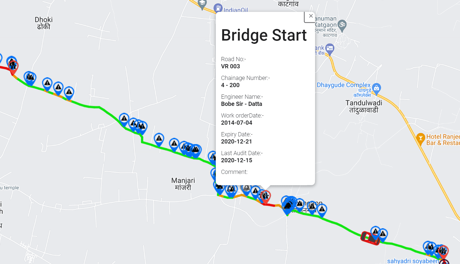
GIS-enabled platforms transform collected data into interactive infrastructure maps.
Decision-makers can visualize:
- Defect density
- Road roughness
- Inspection coverage
- Maintenance history
- Asset condition trends
- High-priority corridors
Mapping helps agencies understand network-wide pavement conditions instead of reviewing isolated inspection reports.
6. Continuous Monitoring
Road conditions change continuously due to traffic loads, weather, and aging.
Rather than performing inspections only once every few years, recurring monitoring enables agencies to observe deterioration as it develops.
Continuous monitoring supports:
- Seasonal comparisons
- Post-storm assessments
- Construction monitoring
- Maintenance verification
- Long-term asset performance tracking
7. Cloud-Based Infrastructure Intelligence
Centralized cloud platforms allow multiple departments to access current road condition information from a single dashboard.
Benefits include:
- Automated reporting
- Historical comparisons
- Data sharing
- Maintenance planning
- Trend analysis
- Network performance monitoring
Cloud-based infrastructure intelligence improves collaboration between engineering, maintenance, and asset management teams.
Understanding Accuracy in Pothole Detection
Accuracy is one of the most important considerations when evaluating pothole detection technology.
However, accuracy should always be viewed within the intended purpose of the system.
Modern smartphone-based platforms are designed to provide network-wide screening and recurring monitoring, helping agencies identify deterioration patterns, prioritize inspections, and support maintenance planning.
Traditional road profilers continue to play an essential role in detailed engineering investigations, acceptance testing, and validation surveys where high-precision engineering measurements are required.
Rather than competing, these technologies work together:
- Smartphone-based monitoring identifies where attention is needed across the network.
- Engineering-grade profilers provide detailed measurements for locations requiring in-depth evaluation.
This complementary workflow enables agencies to deploy specialized survey resources more efficiently while maintaining broad visibility across their entire road network.
AI Improves Detection Consistency
Artificial intelligence reduces the variability associated with manual visual inspections.
Instead of relying solely on individual observations, AI analyzes pavement imagery using consistent detection models.
Benefits include:
- Faster image processing
- Consistent defect identification
- Reduced manual review time
- Improved repeatability
- Better network-level reporting
Human engineers remain essential for validating findings and making engineering decisions, while AI helps scale routine screening across extensive road networks.
The ROI of Pothole Detection Systems
Return on investment extends beyond reducing inspection costs. Modern pothole detection systems deliver value across the entire pavement management lifecycle.
1. Earlier Detection
Identifying deterioration sooner enables preventive maintenance before defects become major failures.
Preventive treatments generally cost significantly less than extensive reconstruction.
2. Better Maintenance Prioritization
With comprehensive network data, agencies can rank roads based on condition rather than relying solely on complaints or periodic inspections.
This supports more objective investment decisions.
3. Increased Inspection Coverage
Traditional inspection programs may cover portions of a network at scheduled intervals.
Smartphone-based monitoring allows organizations to collect data more frequently across larger areas using existing vehicle fleets, improving overall network visibility.
4. Optimized Engineering Surveys
Specialized road profilers remain valuable for detailed engineering investigations.
Network-wide screening helps agencies determine where those detailed surveys will deliver the greatest value, improving the efficiency of engineering resources.
5. Reduced Emergency Repairs
Frequent monitoring helps identify deterioration before it escalates into hazardous potholes requiring urgent intervention.
This supports a shift toward preventive rather than reactive maintenance.
6. Improved Asset Management
Historical pavement data supports:
- Budget forecasting
- Capital planning
- Pavement lifecycle management
- Performance reporting
- Long-term infrastructure strategies
How RoadBounce Supports Modern Pothole Detection
RoadBounce is a smartphone-based infrastructure intelligence platform designed to help agencies, consultants, contractors, and infrastructure owners monitor road networks efficiently and at scale.
The platform combines multiple technologies into a unified road monitoring workflow, including:
- Smartphone-based ride quality measurement
- AI-powered pavement distress detection
- GPS-enabled road surveys
- GIS-integrated infrastructure mapping
- Recurring network monitoring
- Cloud-based analytics
- Historical condition tracking
Rather than replacing traditional engineering profilers, RoadBounce complements established pavement management programs by enabling cost-effective network-wide screening and continuous monitoring. The insights generated help organizations identify priority locations where more detailed engineering investigations or specialized profiler surveys may be appropriate.
Ideal Applications
RoadBounce is well suited for organizations seeking scalable infrastructure intelligence across large road networks, including:
- State Departments of Transportation
- Municipal governments
- Local councils
- Highway authorities
- Road maintenance contractors
- Pavement consultants
- Asset management teams
- Smart city initiatives
- Industrial campuses
- Airport and port operators
Best Practices for Successful Implementation
Organizations achieve the greatest value from pothole detection systems when they:
- Perform recurring network surveys on a regular schedule.
- Combine ride quality data with AI-based visual inspections.
- Integrate condition data into GIS and pavement management workflows.
- Use network screening results to prioritize maintenance investments.
- Deploy engineering-grade profilers for detailed investigations where higher-precision measurements are required.
This integrated approach supports more informed decisions while maximizing the effectiveness of both continuous monitoring technologies and specialized engineering surveys.
The Future of Pothole Detection
Advances in artificial intelligence, smartphone sensors, cloud computing, and geospatial analytics are making road condition monitoring more scalable than ever.
As transportation agencies continue to embrace data-driven asset management, continuous network monitoring will become an increasingly important component of proactive pavement maintenance. By combining recurring smartphone-based surveys with targeted engineering investigations, agencies can improve infrastructure visibility, allocate maintenance budgets more effectively, and extend pavement service life.
Conclusion
Modern pothole detection systems have evolved beyond simple defect reporting into comprehensive infrastructure intelligence solutions. They enable transportation agencies and infrastructure owners to monitor road networks continuously, detect deterioration earlier, and prioritize maintenance based on objective data.
RoadBounce exemplifies this approach by combining smartphone-based ride quality measurements, AI-powered pavement distress detection, GIS mapping, and recurring monitoring into a scalable platform for network-wide road screening. While traditional road profilers remain indispensable for detailed engineering validation and acceptance testing, RoadBounce helps organizations determine where those specialized surveys are needed most—creating a smarter, more efficient pavement management strategy built on continuous infrastructure intelligence.



Leave a Reply