
Road roughness is one of the most important indicators of pavement condition and driving comfort. It directly affects vehicle operating costs, user satisfaction, safety, maintenance planning, and long-term infrastructure investment decisions.
Traditionally, measuring road roughness has required specialized survey vehicles equipped with laser profilers, inertial sensors, and advanced data acquisition systems. While these technologies remain essential for engineering-grade investigations, many road agencies, municipalities, contractors, and infrastructure owners face a common challenge:
How can you monitor road roughness across thousands of miles of roadway without deploying expensive survey equipment everywhere?
The answer lies in modern smartphone-based road condition monitoring technologies that enable cost-effective, network-wide road screening and continuous pavement assessment.
Understanding Road Roughness
Road roughness refers to deviations in the pavement surface that affect ride quality and vehicle response.
As roads age, various factors contribute to increasing roughness:
- Traffic loading
- Pavement settlement
- Weather-related deterioration
- Utility cuts and repairs
- Cracking and deformation
- Surface wear and aging
Higher levels of roughness generally indicate deteriorating pavement conditions and often signal the need for maintenance intervention.
Road roughness is commonly expressed using the International Roughness Index (IRI), which provides a standardized measure of ride quality.
Monitoring roughness over time helps infrastructure managers:
- Assess pavement performance
- Identify deteriorating road segments
- Prioritize maintenance activities
- Allocate budgets more effectively
- Support pavement management programs
Traditional Methods of Measuring Road Roughness
Laser Road Profilers
Laser profilers use high-precision sensors, accelerometers, and inertial measurement systems to create detailed longitudinal pavement profiles.
These systems are widely used for:
- Engineering investigations
- Construction quality assessment
- Acceptance testing
- Research applications
- Detailed pavement performance studies
Response-Type Road Roughness Systems
Earlier generations of roughness measurement relied on vehicle response systems that estimated pavement condition based on suspension movement and ride characteristics. While useful for broad assessments, these systems often lacked the consistency and scalability required for modern network management.
The Challenge of Network-Wide Roughness Monitoring
While traditional profiling technologies provide valuable engineering data, many organizations struggle to use them frequently across large road networks.
Common Challenges
- High Survey Costs: Specialized survey vehicles can be costly to deploy repeatedly.
- Limited Survey Frequency: Many agencies conduct roughness assessments only annually or every few years due to budget constraints.
- Incomplete Network Coverage: Budget limitations often result in only portions of a road network being surveyed regularly.
- Delayed Maintenance Decisions: Infrequent data collection can make it difficult to identify deterioration before it becomes a costly problem.
Measuring Road Roughness Using Smartphones
Advances in smartphone sensors have transformed how road condition data can be collected. Modern smartphones contain:
- Accelerometers
- Gyroscopes
- GPS receivers
- High-performance processors
How Smartphone-Based Road Roughness Monitoring Works
A smartphone mounted inside a vehicle continuously records motion data while driving. The system then:
- Captures Vehicle Response – Accelerometers measure vertical vehicle movement caused by pavement irregularities.
- Records Location Data – GPS coordinates link road condition measurements to specific roadway segments.
- Processes Sensor Data – Algorithms analyze motion patterns and convert them into meaningful road condition indicators.
- Estimates Ride Quality – The platform evaluates ride characteristics and develops roughness-related metrics.
- Creates Network Intelligence – Collected data is aggregated to identify trends, deterioration patterns, and maintenance priorities across an entire network.
The Benefits of Smartphone-Based Road Roughness Measurement
- Cost-Effective Network Coverage: Organizations can collect data across thousands of miles using existing vehicles and smartphones.
- More Frequent Monitoring: Roads can be monitored continuously or at regular intervals instead of annually.
- Faster Data Collection: Large networks can be screened quickly without extensive mobilization.
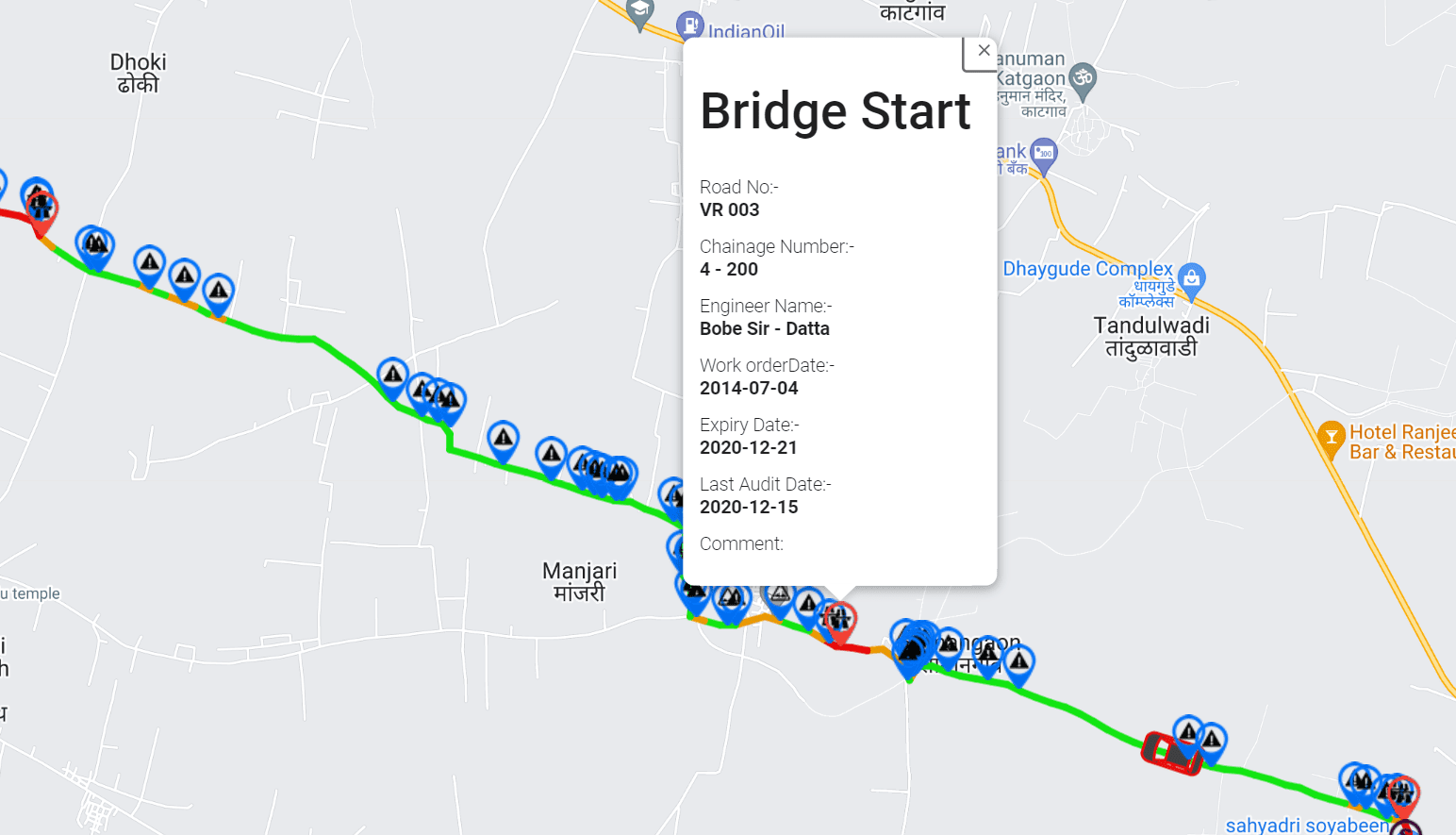
- GIS-Integrated Mapping: Visualize road condition data geographically.
- Better Maintenance Prioritization: Identify which corridors need attention first.
The Role of RoadBounce in Road Roughness Monitoring
RoadBounce is a smartphone-based road condition monitoring and infrastructure intelligence platform designed for network-scale pavement assessment.
It enables agencies, contractors, consultants, and infrastructure owners to:
- Measure ride quality using smartphones
- Monitor road conditions continuously
- Estimate roughness trends across road networks
- Conduct recurring pavement assessments
- Visualize roadway performance using GIS mapping
- Identify deteriorating assets earlier
- Support data-driven maintenance planning
Combining Roughness Data with AI Visual Inspections
RoadBounce integrates roughness monitoring with AI-based distress detection (cracks, potholes, surface deterioration, edge failures, patch failures) and GIS-based analytics for richer infrastructure intelligence.
Network Screening vs Engineering Validation
Network Screening (RoadBounce)
- Monitor entire road networks
- Detect deterioration trends
- Prioritize maintenance needs
- Identify areas requiring further investigation
Engineering Validation (Traditional Profilers)
- Conduct detailed engineering investigations
- Support acceptance testing
- Provide high-resolution profile measurements
Optimizing Pavement Management Programs
Many agencies are moving toward a layered approach:
- Step 1: Continuous Network Monitoring using smartphone-based technology.
- Step 2: Identify Priority Locations showing accelerated deterioration.
- Step 3: Deploy Specialized Surveys strategically where detailed validation is needed.
- Step 4: Prioritize Maintenance Investments based on objective data.
Key Use Cases
- Municipal Road Networks – Monitor local streets more frequently.
- State and Provincial Agencies – Screen large transportation networks continuously.
- Toll Road Operators – Track ride quality trends and improve customer experience.
- Contractors and Consultants – Gather condition data efficiently for projects.
- Asset Owners – Gain greater visibility into pavement performance.
The Future of Road Roughness Measurement
Road infrastructure management is moving toward continuous monitoring, AI-powered analytics, and predictive maintenance. Smartphone-based technologies make it possible to gather road condition information more frequently and across larger areas.
Conclusion
Measuring road roughness no longer requires deploying expensive survey equipment across every mile. Smartphone-based solutions like RoadBounce enable scalable, continuous monitoring and smarter maintenance planning.
The result is a smarter, more proactive approach to managing transportation infrastructure.


Leave a Reply