
Road infrastructure is one of the most valuable public assets, yet maintaining road networks efficiently requires one critical capability: understanding road conditions accurately, consistently, and at scale.
Pavement flatness is one of the most important indicators of road quality, ride comfort, and long-term pavement performance. Whether you’re managing highways, municipal streets, airports, industrial facilities, or large private road networks, accurately measuring pavement flatness helps identify defects early, prioritize maintenance, and optimize infrastructure investments.
Modern road agencies are increasingly combining traditional engineering measurement techniques with smartphone-based road monitoring technologies to obtain a complete picture of network health. While engineering-grade profilers remain essential for detailed investigations and acceptance testing, scalable smartphone-based solutions make it practical to monitor thousands of kilometers of roads continuously.
In this guide, you’ll learn how pavement flatness is measured, the tools available, and how network-wide monitoring supports smarter pavement management.
What Is Pavement Flatness?
Pavement flatness refers to how smooth and even a road surface is over a specified distance. It directly affects:
- Ride quality
- Vehicle operating costs
- Driver comfort
- Road safety
- Fuel efficiency
- Pavement lifespan
- Maintenance planning
Poor pavement flatness often indicates underlying structural issues or surface deterioration that may worsen if left untreated.
Why Measuring Pavement Flatness Matters
Regular pavement flatness assessments enable road owners to:
- Detect surface irregularities early
- Monitor pavement deterioration over time
- Prioritize maintenance activities
- Improve pavement management decisions
- Allocate budgets more effectively
- Enhance road user experience
- Track rehabilitation performance
Rather than waiting until roads visibly fail, continuous monitoring enables proactive maintenance strategies that can reduce lifecycle costs.
Common Methods for Measuring Pavement Flatness
Several techniques are used across the road construction and maintenance industry.
1. Straightedge Method
The straightedge method is one of the simplest techniques for measuring localized surface deviations.
Best for
- Small construction areas
- Spot inspections
- Localized quality checks
Advantages
- Low cost
- Easy to perform
- Minimal equipment
Limitations
- Slow
- Covers only small areas
- Not suitable for network-level assessments
2. Rolling Straightedge
Rolling straightedges evaluate pavement smoothness across longer distances than fixed straightedges.
Common applications include:
- Concrete pavements
- Airport runways
- Industrial floors
- Localized engineering inspections
3. Inertial Road Profilers
High-speed inertial profilers use lasers, accelerometers, and distance measurement instruments to capture highly detailed pavement profiles.
These systems are commonly used for:
- Engineering investigations
- Construction quality assurance
- Acceptance testing
- Research applications
- Detailed pavement analysis
Traditional profilers remain valuable for detailed engineering investigations, while smartphone-based monitoring solutions provide cost-effective network-wide screening and continuous monitoring.
4. Smartphone-Based Road Monitoring
Recent advances in mobile sensing technology have enabled smartphones to measure ride quality using built-in sensors such as:
- Accelerometers
- GPS
- Gyroscopes
Platforms like RoadBounce combine these sensors with artificial intelligence and GIS technologies to monitor road conditions continuously across extensive road networks.
Rather than replacing engineering survey vehicles, smartphone-based monitoring complements traditional profiling programs by identifying sections that may require further engineering evaluation.
Step-by-Step Guide to Measuring Pavement Flatness
Step 1: Define Your Survey Objective
Determine why you’re measuring pavement flatness.
Typical objectives include:
- Routine network monitoring
- Preventive maintenance planning
- Pavement condition assessment
- Rehabilitation planning
- Ride quality evaluation
- Asset management
Your objective will determine the most appropriate survey method.
Step 2: Select the Appropriate Measurement Method
Different applications require different tools.
| Survey Need | Recommended Method |
|---|---|
| Local defect inspection | Straightedge |
| Construction QA | Engineering profiler |
| Acceptance testing | Certified profiler |
| Network-wide screening | Smartphone-based monitoring |
| Recurring condition monitoring | Smartphone-based surveys |
Choosing the right tool ensures accurate and cost-effective data collection.
Step 3: Prepare the Survey Route
Before collecting data:
- Define survey boundaries
- Verify GPS availability
- Inspect weather conditions
- Ensure consistent driving speed where applicable
- Confirm equipment calibration if using engineering instruments
Planning helps improve data consistency and survey efficiency.
Step 4: Collect Road Surface Data
Depending on the selected method:
Traditional Equipment
Laser sensors continuously record pavement elevation changes.
Smartphone-Based Monitoring
Smartphone sensors automatically capture:
- Road roughness
- Ride quality
- Vehicle motion
- Location data
- Speed information
The survey can often be performed using ordinary vehicles traveling during routine operations, making large-scale monitoring practical and affordable.
Step 5: Analyze Surface Irregularities
Collected data is analyzed to identify:
- Uneven pavement
- Rough sections
- Surface deterioration
- Localized defects
- Ride quality changes
Modern AI systems can automatically highlight areas requiring closer inspection.
Step 6: Integrate GIS Mapping
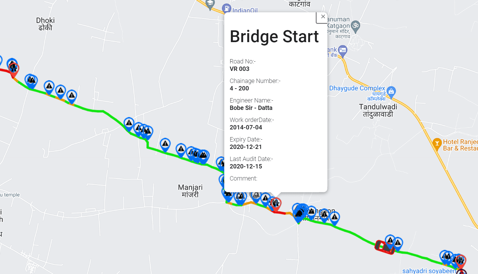
Geographic Information Systems (GIS) transform pavement data into interactive maps.
GIS visualization allows agencies to:
- Locate problem areas quickly
- Compare road segments
- Track deterioration over time
- View network-wide condition trends
- Improve maintenance planning
Spatial intelligence simplifies decision-making across extensive transportation networks.
Step 7: Prioritize Maintenance Activities
After identifying pavement issues:
- Rank road sections by severity
- Estimate maintenance costs
- Schedule repairs
- Monitor repaired segments
- Update pavement management systems
This data-driven approach supports preventive maintenance rather than reactive repairs.
Using Smartphone-Based Technology for Network-Wide Monitoring
Large transportation agencies often manage thousands of kilometers of roads, making frequent engineering surveys difficult due to cost and resource constraints.
Smartphone-based monitoring platforms offer several advantages for network-level assessments:
- Rapid data collection
- Lower operational costs
- Continuous monitoring
- Frequent reassessments
- Wide geographic coverage
- Easy deployment
- Scalable road network intelligence
This enables infrastructure managers to identify changing road conditions much earlier than infrequent survey cycles.
AI-Powered Pavement Distress Detection
Modern road monitoring platforms increasingly incorporate artificial intelligence to identify visible pavement defects such as:
- Cracks
- Potholes
- Edge failures
- Surface wear
- Rutting
- Patching
- Joint deterioration
Combining visual distress analysis with ride quality measurements provides a more comprehensive understanding of pavement condition.
Combining Flatness Measurements with Pavement Management
Measuring pavement flatness becomes even more valuable when integrated into a broader pavement management strategy.
Modern infrastructure intelligence platforms combine:
- Ride quality measurements
- AI visual inspections
- GIS mapping
- Historical condition data
- Recurring monitoring
- Maintenance records
Together, these datasets help agencies make informed decisions about where and when to invest in maintenance.
Network Screening vs. Engineering Validation
Understanding the distinction between network screening and engineering validation is essential for selecting the appropriate assessment approach.
Network Screening
Network screening focuses on monitoring large road networks efficiently to identify sections that may require attention. Smartphone-based platforms support:
- Cost-effective road surveys
- Continuous condition monitoring
- Ride quality assessment
- AI-assisted distress detection
- Maintenance prioritization
- Infrastructure intelligence
- GIS-enabled network visualization
Engineering Validation
Once priority locations have been identified, detailed engineering investigations can be carried out using specialized equipment such as inertial profilers.
These engineering assessments support:
- Construction quality assurance
- Acceptance testing
- Detailed pavement analysis
- Engineering design decisions
- Rehabilitation validation
By combining both approaches, agencies can deploy specialized survey vehicles where they provide the greatest value while maintaining continuous visibility across the entire network.
Best Practices for Measuring Pavement Flatness
For reliable results:
- Establish consistent survey schedules
- Monitor roads throughout the year
- Maintain consistent driving conditions where possible
- Validate priority locations using engineering surveys when necessary
- Integrate condition data into pavement management systems
- Track historical performance trends
- Use GIS for visualization and planning
These practices improve long-term infrastructure management and maintenance efficiency.
How RoadBounce Supports Smarter Pavement Monitoring
RoadBounce is a smartphone-based road condition monitoring and infrastructure intelligence platform designed to help organizations monitor extensive road networks efficiently.
It supports:
- Network-wide road screening
- Smartphone-based ride quality measurement
- AI-powered pavement distress detection
- GIS-integrated road condition mapping
- Continuous road monitoring
- Maintenance prioritization
- Recurring infrastructure assessments
- Data-driven pavement management
RoadBounce complements traditional road profiling programs by enabling frequent, scalable assessments that help identify where detailed engineering investigations may be required. This approach helps optimize the deployment of specialized survey vehicles while providing continuous visibility into network condition.
Conclusion
Measuring pavement flatness is a critical component of effective road asset management. While traditional profilers remain indispensable for detailed engineering investigations, smartphone-based monitoring technologies have transformed how agencies manage large transportation networks.
By combining scalable road condition monitoring, AI-powered pavement inspections, GIS analytics, and recurring assessments, infrastructure managers can detect deterioration earlier, prioritize maintenance investments more effectively, and improve long-term pavement performance.
For organizations responsible for extensive road networks, integrating network-wide screening with targeted engineering validation provides a practical and data-driven strategy for smarter infrastructure management.
Frequently Asked Questions (FAQs)
What is pavement flatness?
Pavement flatness describes how smooth and even a road surface is. It influences ride quality, safety, vehicle operating costs, and pavement longevity.
How is pavement flatness measured?
It can be measured using straightedges, rolling straightedges, inertial profilers, or smartphone-based monitoring systems, depending on the survey objective.
Can smartphone-based monitoring replace engineering profilers?
No. Smartphone-based monitoring is designed for network-wide screening and continuous monitoring. Engineering-grade profilers remain essential for detailed investigations, acceptance testing, and engineering validation.
Why is continuous pavement monitoring important?
Frequent monitoring helps detect deterioration early, supports preventive maintenance, and enables more informed infrastructure investment decisions.
How does RoadBounce support pavement management?
RoadBounce combines smartphone-based ride quality measurements, AI-powered visual inspections, GIS mapping, and recurring monitoring to provide scalable infrastructure intelligence and help agencies prioritize maintenance across large road networks.


Leave a Reply