
International Roughness Index (IRI) is one of the most widely used indicators for evaluating road ride quality and pavement condition. It helps road authorities, transportation agencies, consultants, and infrastructure managers understand how smooth or rough a road surface is and identify locations that may require maintenance.
However, measuring IRI is only one part of an effective road condition assessment. Another important consideration is deciding how long each road segment should be when collecting, analysing, and reporting IRI measurements.
The selected road segment length can significantly influence how road condition data is interpreted, how deterioration patterns are identified, and how maintenance priorities are established.
For example, reporting IRI across an entire 10-kilometre road section may provide a useful overview of overall ride quality. However, it may also hide shorter sections with severe roughness caused by potholes, surface failures, settlement, or deteriorating pavement conditions.
On the other hand, dividing a road into extremely short segments may create large volumes of data, making network-level analysis and maintenance planning more complicated.
Finding the right balance is therefore essential.
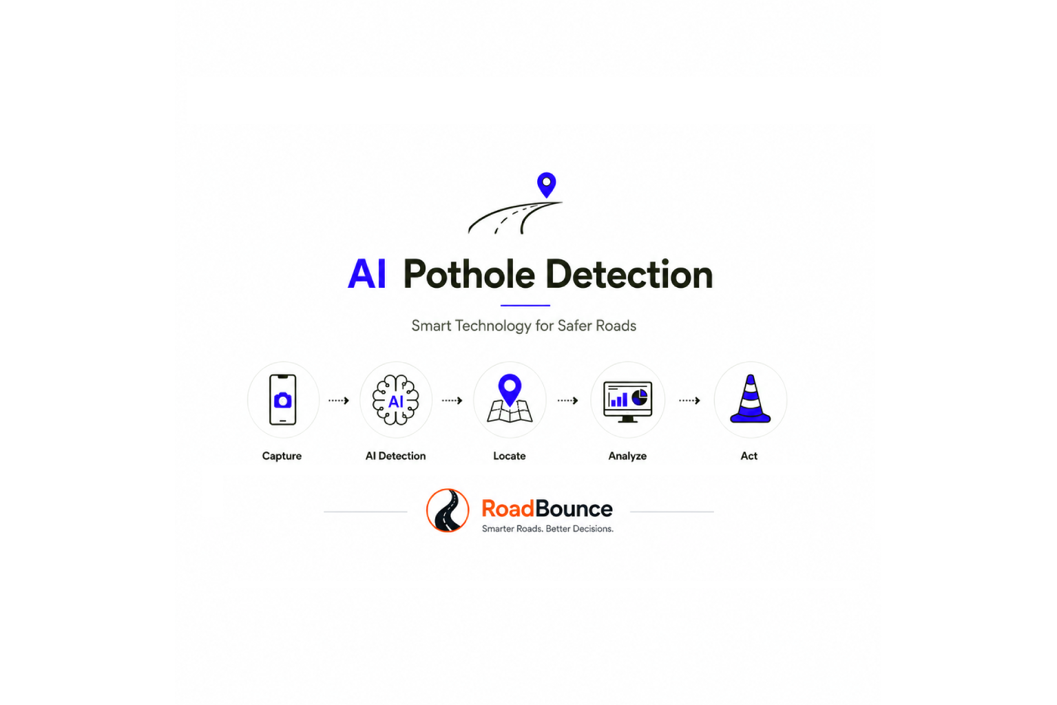
In this guide, we explore how to select appropriate road segment lengths for IRI measurement and reporting, the factors that influence segmentation decisions, and how smartphone-based road monitoring technologies such as RoadBounce can support more frequent and scalable pavement condition assessments.
1. What Is Road Segment Length in IRI Measurement?
Road segment length refers to the distance over which road roughness measurements are aggregated and reported as an IRI value.
Although IRI measurement systems can collect roughness information continuously or at relatively short measurement intervals, road agencies typically organise the collected data into defined reporting segments.
Each segment receives an IRI value, generally expressed in metres per kilometre (m/km), representing the roughness of that particular section.
For example, consider a 5-kilometre road corridor divided into different reporting segments.
| Reporting Segment | Length | IRI Value |
|---|---|---|
| Segment 1 | 500 m | 1.8 m/km |
| Segment 2 | 500 m | 2.2 m/km |
| Segment 3 | 500 m | 4.5 m/km |
| Segment 4 | 500 m | 2.0 m/km |
| Segment 5 | 500 m | 2.4 m/km |
In this example, Segment 3 has considerably higher roughness than the surrounding sections.
If the entire 5-kilometre corridor were represented by a single average IRI value, this deterioration hotspot could become less visible.
This illustrates why selecting an appropriate segment length is important for meaningful road condition reporting.
The objective is not simply to divide roads into equal distances. It is to create reporting segments that support practical infrastructure assessment and maintenance decisions.
2. Why Does Road Segment Length Matter?
Road segment length directly affects the level of detail available to road authorities and pavement management teams.
A carefully selected segment length helps balance network-level reporting with the ability to identify localised pavement deterioration.
Here are five important reasons why segmentation matters.
2.1 Identifying Localised Pavement Deterioration
Road conditions are rarely uniform across an entire corridor.
A road may have relatively smooth pavement for several kilometres, followed by a short section affected by:
- Potholes and surface deformation.
- Uneven pavement patches.
- Rutting and settlement.
- Cracking and surface deterioration.
- Utility cuts and reinstatement failures.
- Drainage-related pavement damage.
Long reporting segments can dilute the influence of these localised defects when measurements are aggregated.
Shorter segments provide greater spatial detail, making it easier to identify sections that require further investigation.
2.2 Improving Maintenance Prioritisation
Maintenance budgets are limited, and infrastructure managers must determine which roads require immediate attention and which can remain under routine monitoring.
Segment-based IRI reporting allows road networks to be divided into manageable maintenance units.
For example:
- Sections with consistently low roughness may require routine monitoring.
- Sections showing increasing IRI values may require preventive maintenance.
- Sections with significantly elevated roughness may require detailed engineering investigation.
This makes it easier to connect road condition measurements with maintenance planning and budget allocation.
2.3 Supporting Meaningful Comparisons
Consistent segment lengths make it easier to compare road conditions across different corridors and assessment periods.
For example, comparing IRI values for 100-metre segments collected in January and June can help identify changes in ride quality over time.
However, comparisons should use consistent:
- Segment boundaries.
- Measurement methodologies.
- Data collection conditions.
- Vehicle and sensor configurations.
- Data processing and aggregation methods.
Without consistency, apparent changes in road condition may reflect differences in measurement or segmentation rather than actual pavement deterioration.
2.4 Improving GIS-Based Road Condition Mapping
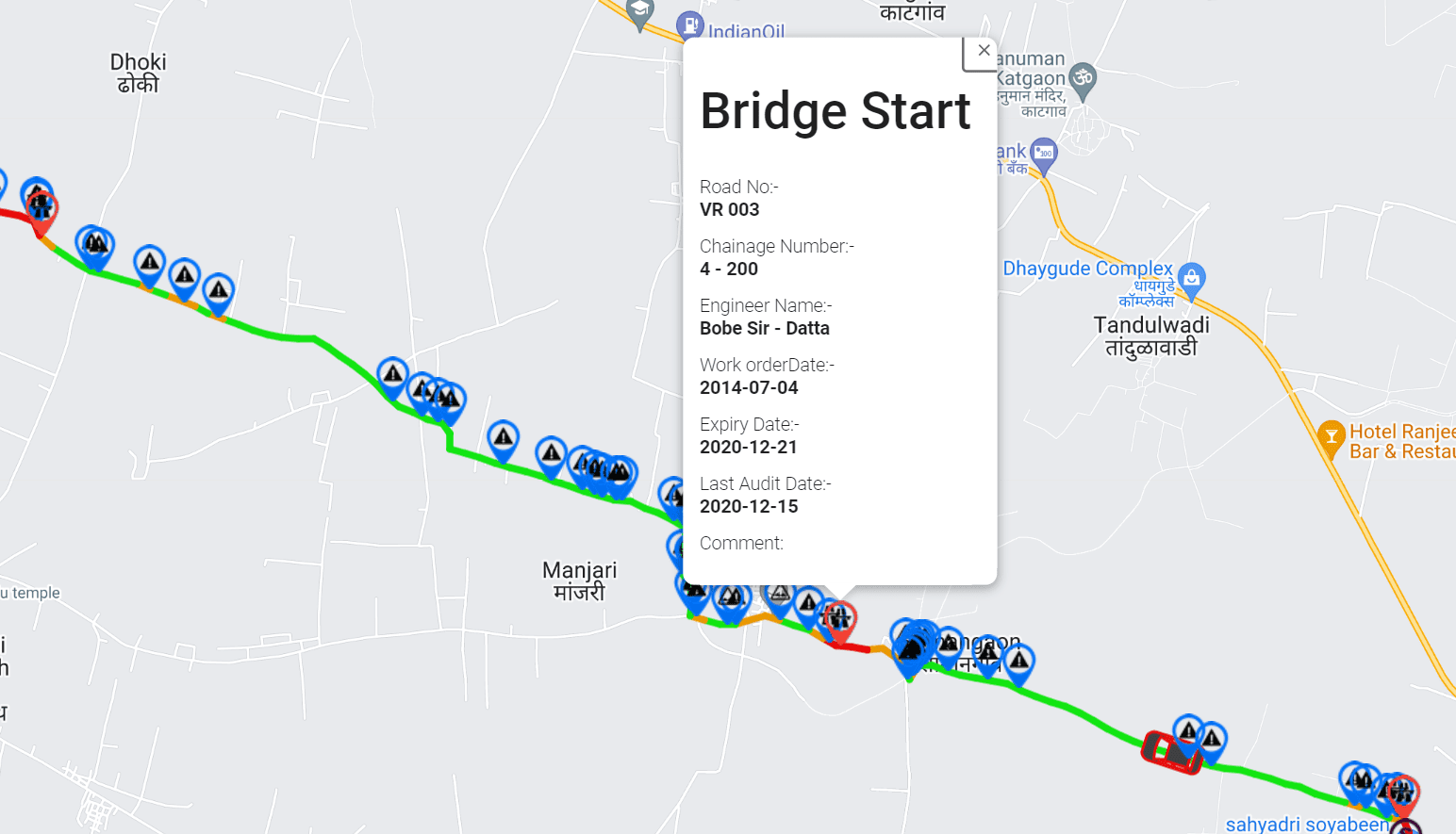
Segment-based IRI measurements can be integrated with Geographic Information Systems (GIS) to create spatial road condition maps.
Each segment can be associated with:
- Geographic coordinates.
- Road identification.
- Chainage or kilometre reference.
- Segment length.
- IRI value.
- Inspection date.
- Pavement distress observations.
This enables infrastructure managers to visualise road roughness geographically and identify deterioration patterns across entire networks.
2.5 Supporting Recurring Road Condition Monitoring
Road conditions change over time because of traffic loading, environmental exposure, water infiltration, pavement ageing, and maintenance activities.
Using consistent reporting segments makes recurring assessments more useful.
Road agencies can compare historical and current measurements to identify:
- Sections experiencing increasing roughness.
- Roads deteriorating faster than expected.
- Locations where maintenance has improved ride quality.
- Areas requiring more frequent inspections.
This transforms IRI reporting from a one-time assessment into an ongoing infrastructure monitoring process.
3. Common Road Segment Lengths Used for IRI Reporting
There is no single segment length that is appropriate for every road monitoring programme.
The ideal length depends on the road network, assessment objectives, reporting requirements, measurement methodology, and the level of detail required by infrastructure managers.
The following table illustrates commonly used segment lengths and their potential applications.
| Segment Length | Typical Application | Main Advantage | Limitation |
|---|---|---|---|
| 10–25 m | Detailed localised analysis | High spatial detail | Large data volumes |
| 50 m | Local road condition assessment | Identifies shorter roughness variations | More complex network reporting |
| 100 m | Detailed network screening | Balances detail and reporting efficiency | May still aggregate very localised defects |
| 200–250 m | Road maintenance planning | Practical for identifying maintenance sections | Less detailed than shorter segments |
| 500 m | Corridor-level assessment | Simplifies network reporting | May hide localised deterioration |
| 1 km | Strategic network assessment | Efficient for large-scale summaries | Limited identification of short problem areas |
Note: These are illustrative reporting intervals, not universal IRI standards or mandatory segment lengths. Actual requirements should follow the applicable road authority’s specifications and survey methodology.
Short Segments: 10–50 Metres
Shorter segments provide more detailed information about local variations in road roughness.
They can be useful when:
- Investigating specific pavement deterioration locations.
- Monitoring short urban road sections.
- Evaluating localised maintenance interventions.
- Identifying variations around intersections and junctions.
- Supporting detailed condition analysis.
However, shorter segments increase the volume of reported data and may introduce greater variability between adjacent measurements.
They should be used when the additional spatial detail provides meaningful value.
Medium Segments: 100–250 Metres
Medium-length segments offer a practical balance between spatial resolution and reporting efficiency.
They are particularly useful for:
- Network-wide road condition screening.
- Identifying deteriorating pavement sections.
- Comparing road conditions across corridors.
- Supporting maintenance prioritisation.
- Integrating IRI measurements with GIS-based road inventories.
For many network monitoring programmes, these lengths provide a useful starting point for developing a consistent reporting framework.
Long Segments: 500 Metres–1 Kilometre
Longer segments are generally more suitable for high-level road network summaries and strategic infrastructure reporting.
They help infrastructure managers understand broader road condition patterns without reviewing thousands of individual measurements.
However, long segments can conceal shorter sections with significantly higher roughness.
For this reason, corridor-level reporting should ideally be supported by more detailed underlying measurements that allow priority locations to be investigated separately.
4. How Segment Length Influences Average IRI Values
One of the most important considerations in road condition reporting is understanding how segment length influences the resulting average IRI.
IRI measurements are typically aggregated over a defined distance.
When the segment becomes longer, local variations are combined into a single reported value.
Consider a hypothetical 500-metre road section containing five consecutive 100-metre intervals.
| 100 m Interval | IRI (m/km) |
|---|---|
| 0–100 m | 1.5 |
| 100–200 m | 1.8 |
| 200–300 m | 5.5 |
| 300–400 m | 2.0 |
| 400–500 m | 1.7 |
IRI Variation Across a 500 m Road Section
Illustrative IRI measurements recorded across five 100-metre intervals.
0 m/km2 m/km4 m/km6 m/km0–100 m100–200 m200–300 m300–400 m400–500 m
IRI values are hypothetical and expressed in m/km.
The 200–300-metre interval has significantly higher roughness than the surrounding road sections.
If the five measurements are averaged equally, the overall IRI is:
IRIaverage=1.5+1.8+5.5+2.0+1.75
IRIaverage=2.5 m/km
The resulting value of 2.5 m/km provides a useful summary of the entire 500-metre section.
However, it does not communicate that one particular 100-metre interval has an IRI of 5.5 m/km.
This is why relying exclusively on longer-segment averages can be problematic when identifying localised pavement deterioration.
Best practice: Retain detailed measurements and report multiple levels of aggregation wherever possible. This allows infrastructure managers to understand overall road condition while retaining the ability to investigate specific problem locations.
5. Factors to Consider When Selecting the Right Segment Length
Selecting an appropriate reporting interval requires more than choosing a convenient distance.
Several operational and technical factors should influence the decision.
5.1 Road Classification
Different road categories have different monitoring and reporting requirements.
For example:
| Road Category | Suggested Starting Point for Reporting | Monitoring Objective |
|---|---|---|
| National highways | 100–500 m | Network condition and maintenance planning |
| State highways | 100–250 m | Corridor monitoring and deterioration identification |
| Urban arterial roads | 50–100 m | Localised roughness and maintenance assessment |
| Residential streets | 50–100 m | Street-level condition monitoring |
| Rural roads | 100–250 m | Cost-effective network-wide screening |
These are indicative planning suggestions rather than prescribed standards. Road agencies should adjust segment lengths based on road characteristics, traffic conditions, survey objectives, and applicable specifications.
5.2 Traffic Volume and Loading Conditions
Roads carrying heavy commercial vehicles may experience different deterioration patterns compared with lightly trafficked residential streets.
High traffic loading can contribute to:
- Pavement fatigue.
- Rutting.
- Surface deformation.
- Localised settlement.
- Accelerated deterioration.
For heavily trafficked corridors, relatively shorter reporting intervals may help identify sections where deterioration is developing.
5.3 Road Geometry and Infrastructure Features
Urban roads and highways contain numerous physical features that can influence ride quality.
These include:
- Intersections and roundabouts.
- Bridges and expansion joints.
- Railway crossings.
- Speed breakers.
- Road junctions.
- Utility reinstatement sections.
- Road construction transitions.
Reporting segments should account for these features where they materially affect the interpretation of measurements.
For example, a bridge transition may require separate analysis rather than being combined with a long adjoining pavement section.
5.4 Data Collection Methodology
The measurement technology also influences the practical level of detail available for reporting.
Traditional inertial profilers collect road profile information using specialised equipment and defined survey procedures.
Smartphone-based road monitoring systems use vehicle-mounted smartphones and motion sensors to collect ride-quality-related data during regular road journeys.
The collected data can be processed into spatially referenced road condition measurements.
When selecting segment lengths, infrastructure managers should consider:
- Data sampling frequency.
- Vehicle speed.
- Sensor configuration.
- Measurement repeatability.
- GPS positioning quality.
- Data processing methodology.
- The intended reporting resolution.
An important distinction is that a shorter reporting segment does not automatically mean more accurate measurements.
The measurement system must have sufficient spatial and technical capability to support the selected reporting interval.
5.5 Maintenance Planning Requirements
Segment length should ultimately support the decisions that road agencies need to make.
If the objective is strategic budgeting across an entire district, longer reporting intervals may be sufficient for high-level summaries.
If the objective is to identify individual road sections requiring maintenance, shorter intervals provide more useful spatial detail.
The best segmentation strategy is therefore one that connects road condition measurements with practical maintenance decisions.
6. Should IRI Be Reported Using Fixed or Variable Segment Lengths?
Another important consideration is whether to use fixed-length or variable-length reporting segments.
Both approaches have advantages, depending on the road monitoring programme.
Fixed-Length Segmentation
Fixed-length segmentation divides roads into consistent intervals, such as every 100 or 200 metres.
Straßenkataster | Vermessungsbüro | Müller & Richter – Müller & Richter
geo-muerich.de
Advantages:
- Simplifies comparisons between different road sections.
- Supports consistent network-wide reporting.
- Makes historical monitoring easier.
- Simplifies GIS integration.
- Enables automated data processing.
Fixed-length segmentation is particularly useful for large-scale pavement management programmes where consistency is important.
Variable-Length Segmentation
Variable-length segmentation uses different segment boundaries depending on road characteristics, infrastructure features, or changes in pavement condition.
Paving the Road Ahead with ArcGIS and AI
esri.com
Advantages:
- Accommodates changes in pavement characteristics.
- Allows separate reporting for bridges and intersections.
- Supports maintenance-section boundaries.
- Can isolate specific deterioration hotspots.
However, variable segmentation can make direct comparisons more complicated, particularly when segment boundaries change between assessment periods.
Which Approach Is Better?
For most network-wide road monitoring programmes, fixed-length segmentation provides a practical foundation.
Variable segmentation can then be introduced where road geometry, pavement characteristics, or maintenance requirements justify additional flexibility.
A hybrid approach often provides the best balance:
- Establish consistent fixed-length reporting segments.
- Maintain detailed underlying measurement data.
- Identify unusual roughness variations.
- Create separate investigation or maintenance sections where necessary.
- Preserve consistent geographic references for future monitoring.
7. How Smartphone-Based Road Monitoring Supports Segment-Level IRI Reporting
Traditional road profiling programmes often rely on specialised survey vehicles equipped with advanced measurement systems.
These systems remain important for detailed engineering investigations, pavement evaluation, and validation activities.
However, conducting frequent detailed surveys across every road in a large network can be operationally challenging.
This creates an opportunity for smartphone-based road monitoring technologies.
Understanding TAC Guidelines with AI for Road Compliance in Canada
roadvision.ai
Platforms such as RoadBounce support scalable road condition data collection using smartphone sensors and associated data processing technologies.
Instead of depending exclusively on specialised survey vehicles for network-wide monitoring, road agencies can collect road condition information through smartphone-equipped vehicles travelling across existing road networks.
This approach supports several important capabilities.
7.1 Scalable Road Condition Data Collection
Smartphone-based monitoring can make it easier to collect road condition information across extensive road networks.
Data collection can be organised around regular vehicle journeys, enabling infrastructure teams to expand monitoring coverage without relying exclusively on dedicated profiling campaigns.
7.2 Segment-Level IRI Reporting
Road condition measurements can be organised into predefined reporting intervals.
Depending on the measurement methodology and data quality, agencies can review IRI-related information across 50-metre, 100-metre, 200-metre, or other selected intervals.
This helps infrastructure managers move beyond corridor-level averages and understand variations across individual road sections.
The selected reporting resolution should always be supported by the system’s measurement capabilities and validation requirements.
7.3 AI-Powered Pavement Distress Detection
Ride quality measurements provide useful information about road roughness, but they do not independently explain every type of pavement distress.
AI-powered visual inspection can complement IRI-related measurements by identifying visible pavement conditions such as:
- Potholes.
- Surface cracking.
- Road deterioration.
- Patchwork.
- Other visible surface defects.
Combining ride-quality information with visual observations helps provide a broader understanding of road conditions.
7.4 GIS-Based Road Condition Visualisation
dTIMS for Pavement Management — Deighton Associates Ltd.
deighton.com
Geospatial integration allows road condition information to be displayed directly on digital road maps.
Infrastructure managers can review individual segments, compare adjacent sections, and identify geographical patterns in pavement deterioration.
This is particularly valuable for municipalities and road agencies responsible for extensive road networks.
7.5 Recurring Monitoring and Historical Comparisons
One of the biggest advantages of a continuous monitoring approach is the ability to revisit road sections regularly.
Instead of relying only on occasional large-scale surveys, infrastructure managers can build historical road condition datasets.
These datasets can help identify deterioration trends and evaluate whether maintenance activities have improved road conditions.
8. Combining Network Screening with Engineering Validation
Selecting appropriate segment lengths is important, but it is equally important to understand the role of different road measurement technologies.
Road condition monitoring should distinguish between network screening and detailed engineering validation.
Stage 1
Network Screening – RoadBounce
Roughometer 4 | Accurate Road Roughness Measurement System
arrbsystems.com
- Monitor extensive road networks.
- Collect recurring road condition data.
- Review segment-level IRI measurements.
- Identify potential deterioration hotspots.
- Prioritise locations for further investigation.
Stage 2
Engineering Validation – Traditional Profilers
Ames Engineering | 8300 Stop and Go Road Profiler
amesengineering.com
- Conduct detailed road profile investigations.
- Validate engineering measurements.
- Support specialised pavement assessments.
- Undertake surveys required by project specifications.
Stage 3
Maintenance Planning and Asset Management
- Evaluate identified problem locations.
- Develop maintenance priorities.
- Allocate resources effectively.
- Monitor post-maintenance conditions.
Traditional profilers remain valuable for detailed engineering investigations, while smartphone-based monitoring solutions provide cost-effective network-wide screening and continuous monitoring.
This complementary approach helps agencies identify where specialised survey vehicles should be deployed instead of depending exclusively on detailed profiling campaigns for every road section.
9. Recommended Best Practices for IRI Segment Length Selection
To establish a consistent and effective IRI reporting framework, road agencies should consider the following practices.
1. Define the monitoring objective first.
Determine whether the assessment is intended for network screening, maintenance planning, corridor evaluation, or detailed engineering investigation.
2. Establish standard reporting intervals.
Select a consistent baseline segment length, such as 100 metres, for detailed network screening where supported by the measurement system.
3. Retain underlying measurement data.
Avoid storing only aggregated IRI values. Preserve the underlying measurement records wherever possible to support further analysis.
4. Use consistent geographic references.
Ensure that road identifiers, chainage references, GPS coordinates, and segment boundaries remain consistent between assessment periods.
5. Identify localised deterioration.
Use shorter reporting intervals or additional investigation windows where unusual roughness variations are identified.
6. Combine IRI with other road condition indicators.
IRI should be considered alongside pavement distress observations, visual inspections, road geometry, and other relevant infrastructure information.
7. Monitor roads repeatedly.
Recurring assessments help identify changes in pavement condition and support preventive maintenance planning.
8. Validate important findings.
Use appropriate engineering investigations and specialised profiling equipment when detailed validation is required.
10. A Practical Example: Selecting Segment Length for a 100-Kilometre Road Network
Consider a municipal authority responsible for maintaining a road network covering 100 kilometres.
The authority wants to understand road condition variations, identify deteriorating sections, and establish maintenance priorities.
Rather than reporting the entire network using a single average IRI value, it decides to implement a structured segment-based monitoring programme.
The following example illustrates how different segment lengths affect the number of reporting units.
| Segment Length | Number of Reporting Segments |
|---|---|
| 25 metres | 4,000 |
| 50 metres | 2,000 |
| 100 metres | 1,000 |
| 200 metres | 500 |
| 500 metres | 200 |
| 1 kilometre | 100 |
Reporting Segments Across a 100 km Road Network
Number of reporting units generated at different fixed segment lengths.
01,5003,0004,50025 m50 m100 m200 m500 m1 km
A 100-metre reporting interval generates 1,000 individual segments.
This provides a manageable structure for network-level screening while retaining sufficient spatial detail for identifying potentially deteriorating road sections.
The authority could implement the following workflow:
- Collect smartphone-based road condition data across the network.
- Organise measurements into 100-metre reporting segments.
- Generate segment-level IRI summaries.
- Integrate visual pavement distress observations.
- Display road conditions through GIS-based mapping.
- Identify sections requiring maintenance attention.
- Prioritise selected locations for detailed engineering investigation.
- Repeat assessments periodically to monitor deterioration.
This approach creates a structured road condition database that can support ongoing pavement management activities.
Importantly, the 100-metre interval is a practical example rather than a universal recommendation. The final segment length should be determined by the authority’s monitoring objectives and measurement capabilities.
11. Common Mistakes to Avoid When Defining IRI Reporting Segments
Even well-designed road monitoring programmes can produce misleading results if segmentation is not handled correctly.
Here are some common mistakes to avoid.
| Common Mistake | Why It Matters | Recommended Approach |
|---|---|---|
| Using only long reporting segments | Localised deterioration may be hidden | Retain shorter underlying measurements |
| Selecting extremely short segments without justification | Creates unnecessary data complexity | Match resolution to monitoring objectives |
| Changing segment boundaries between surveys | Makes historical comparisons difficult | Maintain consistent reference points |
| Ignoring GPS accuracy | Can result in incorrect spatial attribution | Review positioning quality |
| Treating segment averages as complete road assessments | Averages may conceal local defects | Combine IRI with visual inspections |
| Assuming shorter segments mean higher accuracy | Reporting resolution and measurement accuracy are different | Validate measurement methodology |
| Using IRI as the only maintenance indicator | Roughness does not describe every pavement failure | Combine multiple condition indicators |
Avoiding these mistakes helps improve the reliability, usability, and long-term value of road condition datasets.
12. The Future of Segment-Based Road Condition Monitoring
Road infrastructure management is gradually moving towards more frequent, data-driven, and geographically integrated monitoring systems.
Instead of relying exclusively on periodic road surveys, infrastructure owners increasingly need solutions that can provide ongoing visibility into road network conditions.
This creates opportunities for technologies combining:
- Smartphone-based road data collection.
- Automated IRI-related measurement processing.
- AI-powered pavement distress detection.
- GIS-integrated road condition mapping.
- Historical road condition databases.
- Recurring monitoring and deterioration analysis.
- Data-driven maintenance prioritisation.
The combination of these technologies can help road agencies build a more complete understanding of infrastructure conditions.
The objective is not simply to measure road roughness more frequently. It is to make road condition information more accessible, actionable, and useful for infrastructure management.
Platforms such as RoadBounce support this direction by bringing scalable road screening, ride-quality monitoring, visual pavement inspection, and geospatial intelligence into a connected monitoring approach.
Conclusion: Choosing Segment Lengths That Support Better Road Management
Selecting the right road segment length is an important part of designing an effective IRI measurement and reporting programme.
Longer segments provide useful corridor-level summaries, while shorter segments help identify localised variations in road roughness.
For many network-wide monitoring programmes, fixed reporting intervals of 100–200 metres can provide a practical starting point, provided the measurement methodology supports that level of detail.
However, the most effective approach is not to rely on a single reporting interval. It is to combine consistent segment-based reporting with access to detailed underlying measurements and the flexibility to investigate individual problem locations.
With smartphone-based road monitoring, AI-powered visual inspections, GIS integration, and recurring assessments, infrastructure managers can move towards more proactive and data-driven road maintenance.
RoadBounce helps make this possible by supporting network-wide road screening and continuous infrastructure monitoring, enabling road agencies to identify deterioration earlier, prioritise maintenance investments, and determine where detailed engineering investigations are required.
The result is a smarter approach to understanding and managing road network conditions.

Leave a Reply