
Road roughness is one of the most important indicators of pavement performance and ride quality. Whether managing a city street network, state highway system, toll road, or private transportation corridor, understanding road roughness helps infrastructure owners make informed maintenance decisions, prioritize investments, and improve user experience.
As road networks continue to expand and budgets remain constrained, agencies are increasingly looking for scalable ways to monitor pavement conditions across thousands of miles of roadway. This has led to growing interest in smartphone-based road roughness measurement technologies that complement traditional engineering survey methods by enabling continuous, network-wide monitoring.
In this guide, we’ll explore what road roughness is, how it is measured, the tools used for data collection, accuracy considerations, and how modern infrastructure intelligence platforms like RoadBounce support smarter pavement management.
What Is Road Roughness?
Road roughness refers to irregularities in a pavement surface that affect vehicle motion, ride comfort, safety, and long-term pavement performance.
These surface deviations may result from:
- Pavement aging
- Traffic loading
- Environmental conditions
- Settlement and deformation
- Construction defects
- Utility cuts and repairs
- Freeze-thaw cycles
- Drainage issues
As roughness increases, drivers experience a less comfortable ride, vehicle operating costs may increase, and infrastructure owners face growing maintenance requirements.
Road roughness serves as an important indicator of overall pavement health and often provides an early warning of deterioration that may require further investigation.
Why Measuring Road Roughness Matters
Road roughness data supports multiple infrastructure management objectives.
Better Maintenance Planning
Regular roughness monitoring helps agencies identify roads that are deteriorating before visible failures become severe.
Improved Budget Allocation
Data-driven prioritization ensures maintenance funding is directed toward the roads that need attention most urgently.
Enhanced Asset Management
Road roughness metrics provide valuable inputs for pavement management systems and long-term infrastructure planning.
Improved Road User Experience
Smoother roads contribute to better ride quality, increased safety, and reduced vehicle wear.
Network Performance Monitoring
Agencies can track pavement performance trends over time and evaluate the effectiveness of maintenance interventions.
The International Roughness Index (IRI)
The most widely recognized metric for road roughness measurement is the International Roughness Index (IRI).
IRI quantifies pavement roughness by simulating how a standard vehicle suspension responds to road surface characteristics.
The result is typically reported as:
- Meters per kilometer (m/km)
- Inches per mile (in/mi)
Lower IRI values generally indicate smoother roads, while higher values indicate rougher pavement conditions.
Methods of Road Roughness Measurement
1. Traditional Road Profilers
Road profilers use specialized sensors, lasers, accelerometers, and distance measurement instruments to collect highly detailed pavement profile data.
These systems are commonly deployed for engineering investigations, construction quality assessments, pavement research, acceptance testing, and detailed condition evaluations.
2. Inertial Profiling Systems
Inertial profilers combine multiple sensors to calculate pavement surface profiles while vehicles travel at highway speeds.
3. Smartphone-Based Road Roughness Measurement
Recent advancements in mobile technology have enabled smartphones to serve as powerful road condition monitoring tools.
Using built-in sensors such as accelerometers, GPS receivers, and gyroscopes, smartphone-based systems can collect ride quality data while vehicles travel normally throughout a road network.
This approach enables frequent assessments, broad geographic coverage, cost-effective data collection, continuous monitoring programs, and network-scale screening.
How Smartphone-Based Monitoring Works
Modern platforms such as RoadBounce leverage smartphone sensors combined with advanced analytics to evaluate pavement ride quality.
The process typically includes:
- Data Collection – A smartphone mounted within a vehicle continuously records motion data while driving.
- Location Tracking – GPS coordinates associate roughness measurements with specific roadway segments.
- Signal Processing – Algorithms analyze vehicle movement patterns to estimate road roughness characteristics.
- Cloud-Based Analysis – Collected data is uploaded to centralized platforms for processing and reporting.
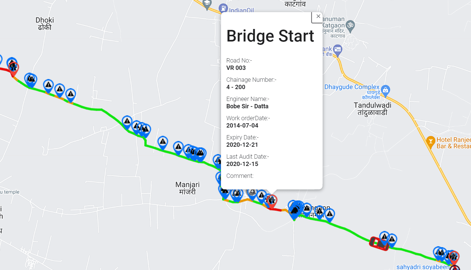
- Network Visualization – Results are displayed through GIS-based dashboards that allow users to identify trends and problem areas.
The Role of AI in Road Condition Monitoring
Road roughness is only one component of pavement health. Modern infrastructure management increasingly combines ride quality measurements with AI-powered visual inspections.
RoadBounce integrates multiple data sources to provide a more comprehensive view of pavement conditions, including roughness trends, surface distress detection, crack identification, pothole recognition, asset mapping, and geospatial analysis.
Understanding Accuracy in Road Roughness Measurement
Engineering validation requires specialized survey equipment. Network screening benefits from broad coverage and recurring observations.
RoadBounce is designed to support network screening by helping agencies continuously monitor roadway conditions and identify locations that may warrant detailed engineering investigation.
Network Screening vs Engineering Validation
Network Screening focuses on entire road networks, frequent assessments, deterioration monitoring, maintenance prioritization, infrastructure intelligence, and resource optimization.
Engineering Validation focuses on detailed pavement analysis, construction quality verification, project acceptance, research-grade investigations, and high-resolution profiling.
Benefits of Continuous Road Roughness Monitoring
Modern smartphone-based monitoring enables more frequent assessments, earlier deterioration detection, better investment decisions, optimized survey resources, and improved infrastructure intelligence.
GIS-Based Infrastructure Analytics
RoadBounce combines roughness measurements with location intelligence to provide interactive maps, condition heatmaps, segment-level analysis, historical trend tracking, and maintenance prioritization workflows.
Road Roughness Measurement and Pavement Management
Road roughness monitoring contributes to asset condition assessments, maintenance planning, budget forecasting, performance tracking, risk management, and lifecycle optimization.
The Future of Road Roughness Measurement
Emerging trends include smartphone-based surveys, AI-assisted condition assessment, cloud-based infrastructure analytics, automated deterioration tracking, digital asset management, and predictive maintenance planning.
Conclusion
Road roughness measurement plays a critical role in understanding pavement performance, improving ride quality, and guiding infrastructure investment decisions.
While traditional profilers remain valuable for detailed engineering investigations and validation surveys, smartphone-based monitoring technologies offer a powerful solution for network-wide screening and continuous road condition assessment.
RoadBounce combines smartphone-based roughness measurement, AI-powered pavement inspections, GIS mapping, and recurring monitoring to help agencies collect road condition data at scale, identify emerging issues earlier, prioritize maintenance investments, and make more informed asset management decisions.
By complementing traditional profiling programs rather than replacing them, RoadBounce enables a smarter, more scalable approach to monitoring large road networks and building long-term infrastructure intelligence.


Leave a Reply